


- Area
- West Coast
- Distance
- 48.8km
- Total Ascent
- 3315m
- Time
- 4-5 days
- Grade
- Difficult
- Accom.
- Frew Hut (10 bunks), Frew Saddle Biv (two bunks), Bluff Hut (six bunks), Toaroha Saddle Biv (two bunks), Cedar Flat Hut (12 bunks)
- Access
- From either the Whitcombe Valley Road end or Middlebranch Road. Car shuttle required.
- Map
- BV18, BV19
- Notes & Map
- Toaroha Circuit, West Coast (pdf, 1 MB)
- GPX File
- Toaroha Circuit (gpx, yo 127 KB)
- Your device does not support GPX files. Please try a different device.
The Toaroha to Lower Whitcombe track is typically hiked from the Cedar Flat end, up the Toaroha River and out via the Hokitika and Whitcombe rivers. This description, elevation profile and maps start from the Whitcombe end.
Make your way up the river flats and along the track, crossing the cableway to reach Rapid Creek Hut. From here it is generally easy going alongside the azure blue Hokitika and Whitcombe rivers to Frew Hut.
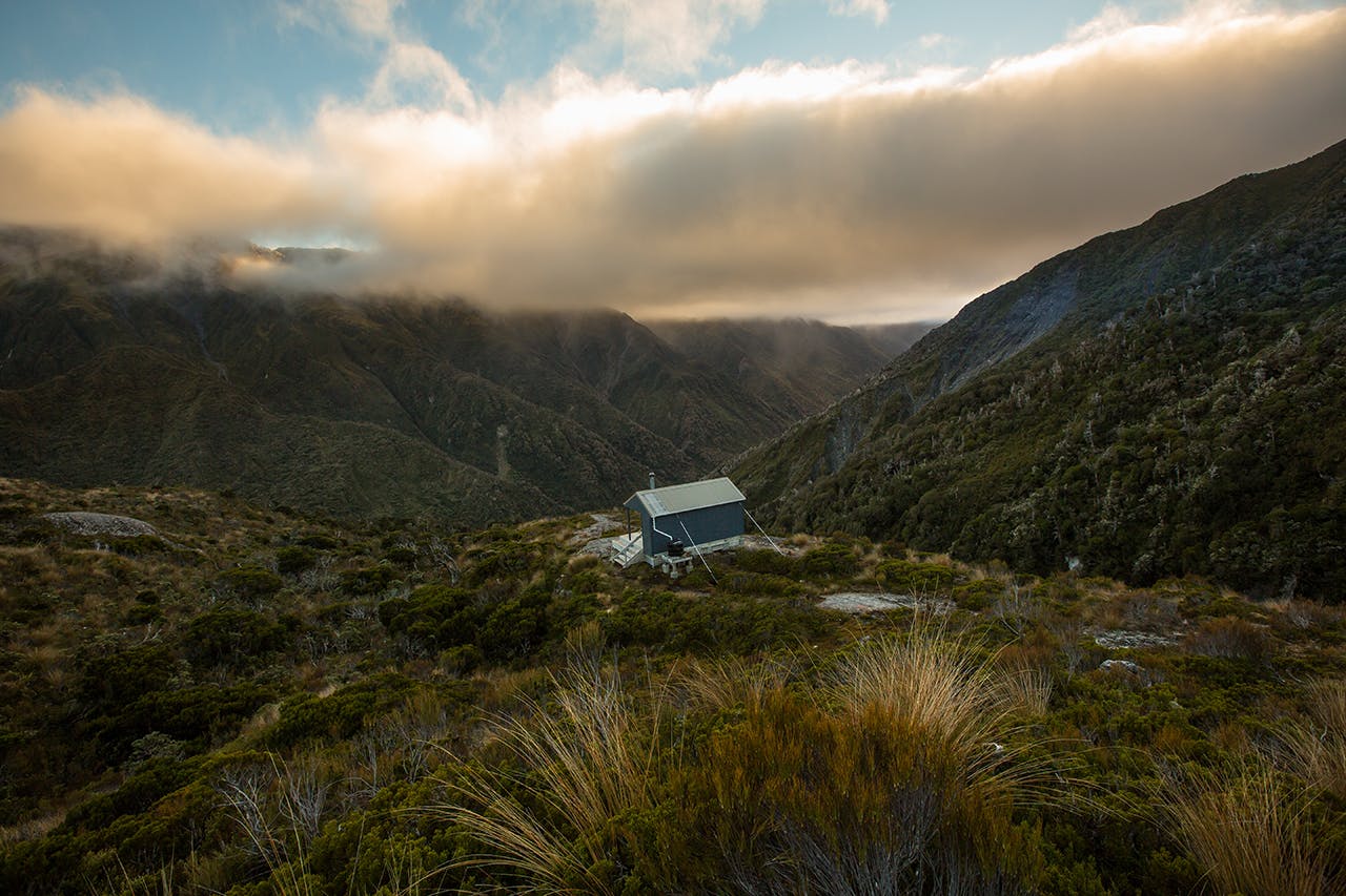
The second day involves a steep climb of some 1000m up Frew Creek to Frew Saddle and biv. It will take 4-5hr to reach the saddle from where views extend for miles down the valleys on either side and the tussock will shine gold in the afternoon sun. Stay at the biv or drop down to the Hokitika River and make your way to Bluff Hut – another 2-3hr distant.
The way is poled and route finding relatively easy. Bluff Hut sits atop an enormous rock with a commanding view of the surrounding mountains and has a precarious path to the loo – use a headlamp!
Carrying on from Bluff Hut, a sheer, tree-hugging descent leads to a sturdy swingbridge over the Hokitika River to access the track that runs alongside the Mungo River. Between the bridge and Poet Hut, the trail, though only 4km, is a rollercoaster of steep ups and downs.
Poet Hut is cute and colourful, with plenty of charm and a cosy open fire. Staying here will mean a very long following day to reach the road end, or adding an extra day to your trip. It might be best to head to Taroha Saddle Biv – a two-bunker. From Poet Hut a 700m climb leads to the biv. It’s grueling, probably more so than the previous section of track, but at least you feel like you’re making progress. Once above the treeline, it is a quick scramble to the biv.
The track leading from the biv into the headwaters of the Toaroha River is not for the faint of heart. The slope is dizzying in its steepness and falls away through tussock and spaniard, sprinkled with hidden potholes and narrow ditches. The track eventually levels out and weaves pleasantly past low marsh, where Top Toaroha Hut is situated and then back into the forest for the final stretch to Cedar Flat Hut.
There are hotpools near the hut – but these won’t be accessible if rain has caused river levels to rise. It’s only 3-4hr from Cedar Flat to Middlebranch Road. Those looking for a classic Kiwi backcountry experience can find this, and a whole lot more, on this fantastic route.
