


- Distance
- 8.45km
- Total Ascent
- 882m
- Time
- 5-6hr
- Grade
- Easy/Moderate
- Access
- The car park is close to the Wooded Gully Campground and Picnic Area on Hayland Road
- Map
- BW23
- GPX File
- mt-thomas (gpx, yo 20 KB)
- Your device does not support GPX files. Please try a different device.
No less than four tracks begin at the car park in the Mt Thomas Forest Conservation Area, which covers 10,800ha between the Ashley and Okuku rivers.
The Summit Track up Mt Thomas offers consistent forest coverage, which is great if it’s a hot day.
After crossing a plush lawn, the track starts off rather scruffily, crossing an area of scrub and hopping a stile next to a logging road. Then the climb begins in earnest, heading straight up, for 30 minutes, through a tunnel of sweet-smelling pine trees.
The track exits the trees momentarily to cross the logging road, but the upward grind continues, although, thankfully, with a few wiggles to the route.
The track becomes more interesting as zigzags finally materialise. After an age, it abruptly pops out of the pine trees to turn left onto a wide track that spirals around the edge of the hill.
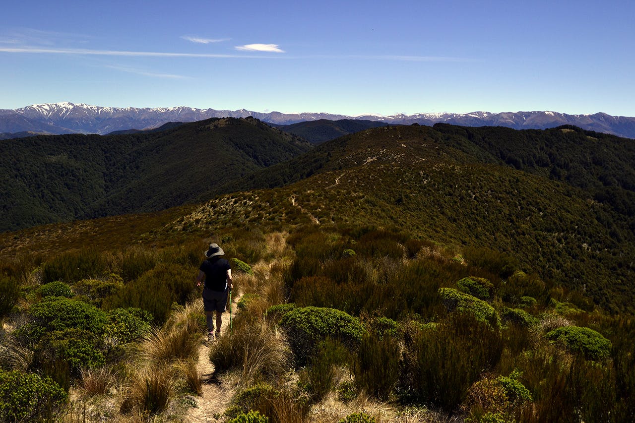
To the south are views all the way to Christchurch and the Port Hills. The track joins a logging road just before reaching the summit.
It is not the most scenic summit, endowed as it is with a wide flat expanse of grass, a jumble of meteorological towers and a large trig. But the views of the Canterbury Plains and the curve of ocean, the Lees Valley and the tops of the Puketeraki Range make it a perfect place to have lunch.
Continue along the Ridge Track, crossing a bush saddle covered with tussock, daisies and turpentine scrub. The track then dives off left and returns to the forest. In contrast to the pine trees of the Summit Track, this section is a remnant of the old beech and podocarp forests that once covered the area and is all the nicer for it.
A steep rocky path leads to a junction, where you can continue on the Ridge Track or turn onto Wooded Gully Track. The latter is probably more interesting, shorter and with several creek crossings.
It’s a roller-coaster of a route. Cross a ridge with trees dropping down either side, tackle several creek crossings, and share the track with a stream for 50m.
Eventually the track settles into downhill mode, with several long zigzags, passing through a stand of fire-blackened trees and bottoming out at a bridge with a picnic table beside the wide river.
Re-cross the lush lawn to return to the car park.
