


Red Hill’s a winner
Tucked into a corner of Korowai-Torlesse Conservation Park, directly south of Porters Heights ski field, near Coleridge Saddle, is the seldom-climbed Red Hill, 1641m.
It sits a few kilometres south-west of Lake Lyndon on SH73, but is not so easily climbed from the lakeshore as it entails a moderately long ridge traverse to reach the summit.
The ski field road allows for a much closer and, in many ways, more interesting approach to the mountain and a startlingly beautiful high country valley and landscape – the upper Porter River. It was my choice for a trip with a difference when looking for a not too faraway summit to tackle in the winter months.
Being close to Christchurch, and with a shortened approach walk, it seemed a fine way to spend a sparkling winter’s day.
I arrived before the ski field opened and, to avoid traffic hassles, parked at the foot of the zig-zags in the road to the field, just above the river. I grabbed my gear, dropped over the edge of the tussock terrace, skirted some icy snow and was in the Porter Riverbed heading up in quick time.
The river is a delight and has a sort-of-track winding along the broad terraces, through the waving heads of the tussock, all the way to the foot of Coleridge Saddle.
There are great views through here, especially up onto the wide, steep slopes of Blue Hill, 1946m, which was sleek with deep winter snow almost all the way to the river.
At the pass, it was a see-which-way-works-best route as I headed up a narrow rib which looked to give access all the way to the summit ridge and the snow.
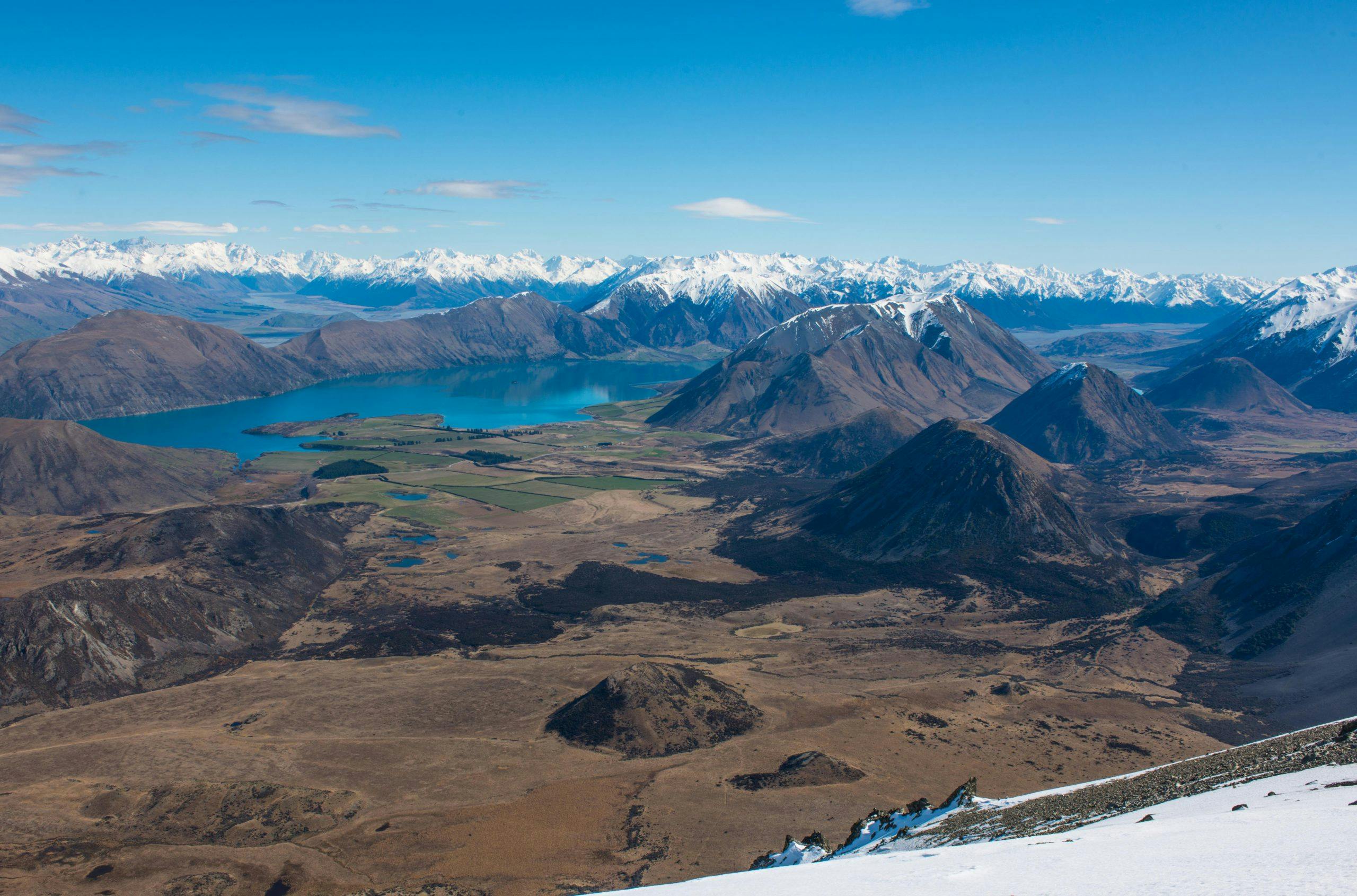
At 1500m, where the rib merged into the main ridgeline, there is the most stunning view of the Lake Coleridge Basin. The region, known for its breathtaking backdrop of mountain, lake and terrace scenery, was drop-dead gorgeous from this high vantage. Summits around the lake protruded from the terrain like Egyptian pyramids. For long moments I couldn’t prise my eyes away but eventually the call of the summit spurred me on.
The snow was firm and I briefly regretted not bringing crampons as I kicked and cut steps along the exposed ridge crest.
From the summit, it was more photos of the basin and surrounding summits to the north before I headed down, carefully at first past a steep snow face, and then with growing speed through tussock and scree to a long rest and drink at the river. Mid-afternoon saw me stomping down the terraces beside the Porter River, pausing every so often to marvel at the beauty around me.
Red Hill had proved a winner.
- Distance
- 4.38km to summit
- Total Ascent
- 700m
- Grade
- Moderate
- Time
- 2-3hr to summit
- Access
- Take SH73 to Porters Pass and on to Porters Heights Ski Field. Park just above the café at the base of the zig-zag to the ski field
- Map
- BW20
GPX File
- Red Hill (gpx, 3 KB)
GPX File
- Your device does not support GPX files. Please try a different device.
