


- Distance
- 2.53km
- Total Ascent
- 401m
- Time
- 3hr return
- Grade
- Easy/Moderate
- Access
- From Link-Kakaho Road
- Map
- BF34
- Notes & Map
- Pureora, Pureora Forest Park (pdf, 12 MB)
- GPX File
- Pureora (gpx, yo 8 KB)
- Your device does not support GPX files. Please try a different device.
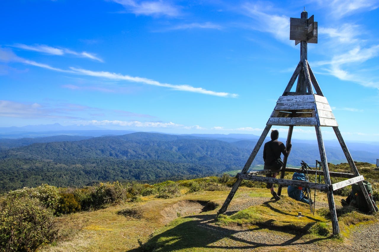
While the low-angled volcanic cone of Pureora (1165m) may be a relatively minor summit, its panoramic views are some of the best in the North Island. From the summit trig, an impressive array of other mountains surround you in one great 360-degree arc: Mt Taranaki, the Herangi Range, Mts Karioi, Pirongia, Maungatautari, Tauhara, the Kaimanawa Ranges, the Tongariro volcanoes, and of course the Hauhungaroa Range, of which Pureora forms just one summit. Closer to hand is Titiraupenga, Pureora’s sister summit, with its distinctive rock spire.
Two tracks lead to the top, with the most accessible beginning from Link-Kakaho Road. The climb starts gradually, through forest dominated by totara and rimu, and the understory festooned with ferns. Bridges span three streams, then, higher up, the gradient increases with steps and boardwalks leading through the increasingly stunted forest. Shortly after breaking through the bushline, the summit trig is reached.
Allow three hours return. Those who have made suitable transport arrangement can descend the alternative Toi Toi Track, which links with the Timber Trail.
