


Simply stunning
In just a few meandering hours on the Pouakai Crossing, a melange of wild landscapes is unravelled; subalpine shrublands and flowers, mountain cedar and misty moss-laden ‘goblin’ forests, a sprawling wetland, rolling tussock tops and tarns and, providing the drama, massive volcanic cliffs looming above the track. Standing symmetrically, sentinel over everything, is Taranaki Mounga.
Much of the crossing is above the bushline, exposed to sudden bad weather. As with the Tongariro Alpine Crossing, people need to accept there will be days they simply shouldn’t go.
Weather aside, the Pouakai Crossing is easy to follow, rocky underfoot mixed with steps, bridges and boardwalk.
Due to a slip closing the Holly Hut Track, it’s logical to start at the lower car park, near North Egmont Visitor Centre. Walkers must first take Ram Track and then the Kokowai Track to avoid the closed section of Holly Hut Track. This adds at least one hour to the trip.
Kokowai Track is fairly relentless in its ascent, gaining 600m in altitude over 4km. Below the track, the orange-red ochres of Kokowai Stream stand out. The iron oxides which colour the stream are used as decorative dyes and are prized by local iwi – this valley was defended stoutly from early marauders.
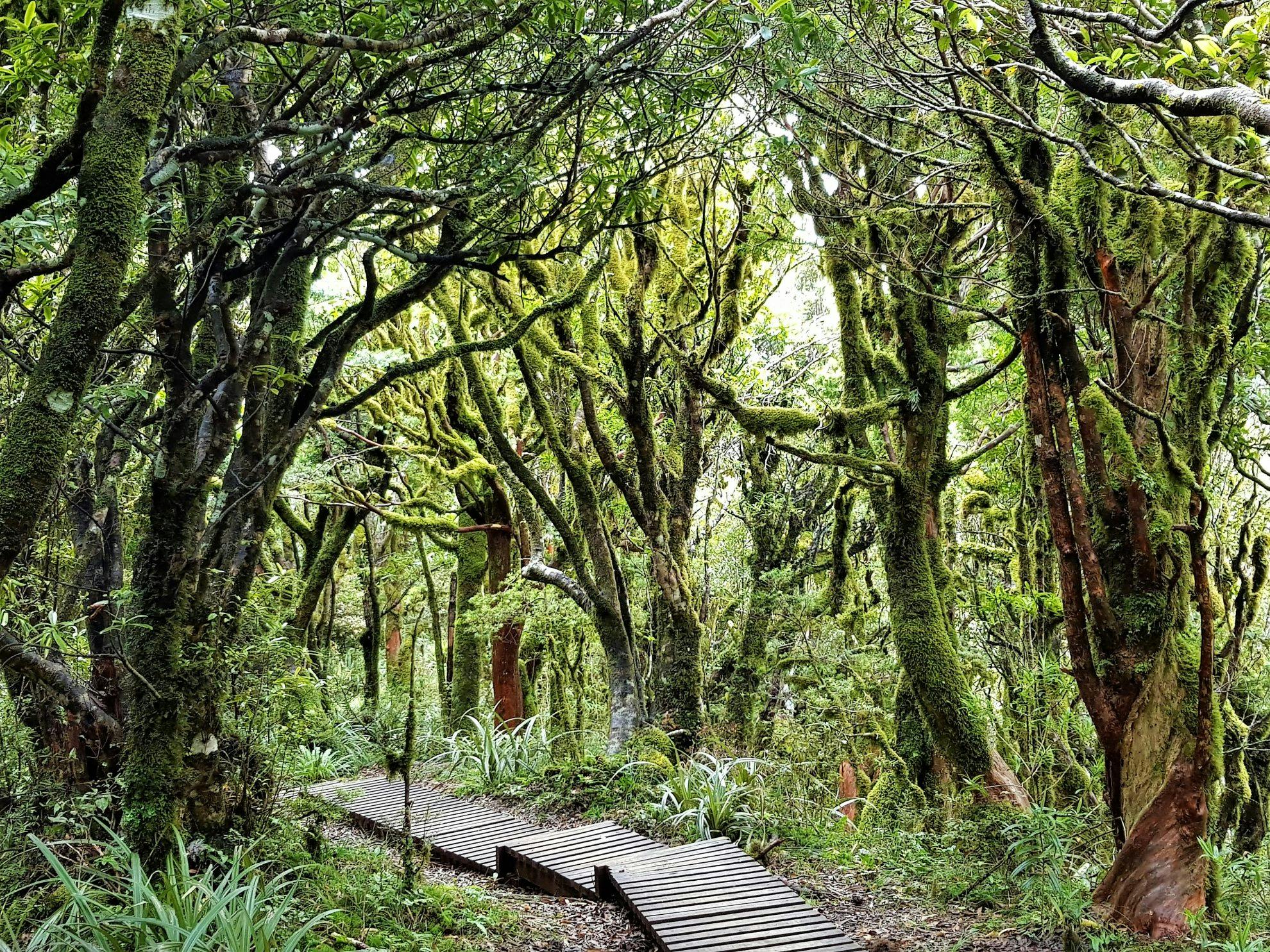
When the Kokowai Track meets Holly Hut Track, you’re in an alpine environment and subalpine shrubs, red tussocks and herbs add a gentle touch to the steep eroded trails. In summer, alpine flowers line the path, including Celmisia gracilenta.
Soon after this junction, Ahukawakawa Swamp comes into view, though the swamp is surely a sad moniker for this rare subalpine wetland that harbours more than 260 native herbs, mosses, sedges and more, including many found nowhere else in the world. It was formed 3500 years ago when the cumulo lava extrusion known simply as The Dome (towering behind the wetland) blocked a stream.
From the first wetland view, a gentle descent leads to Holly Hut, named for the mountain holly common around here. It’s a good spot for lunch if the weather is dodgy. An easy hour return side trip from the hut takes in Bells Falls, which plunge a spectacular 31m off The Dome.
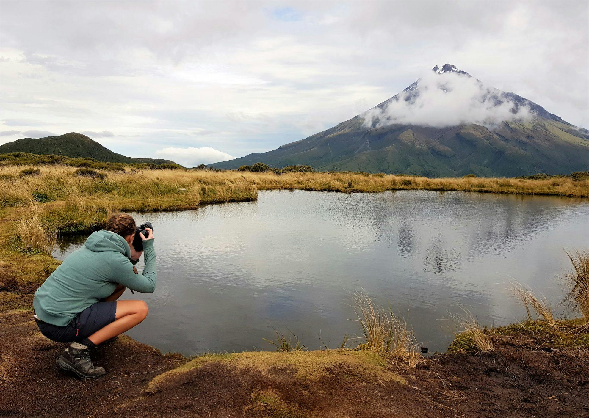
Boardwalks across the wetland might keep your feet dry, but don’t count on it. Expect mud on the steep climb to the Pouakai Range. Wend across the tussock tops and divert a few hundred metres to the tarn (it’s signposted) where you may be lucky enough to view Mt Taranaki reflected in the water.
Pouakai Hut is nestled on the north side of the Pouakai Range, it overlooks low growing totara/kamahi forest that blankets the volcanic ‘ring plain’. From the hut, the final descent begins down the Mangorei Track. Some even walk this track in the dark to get to the tarn for sunrise.
- Distance
- 17km
- Total Ascent
- 1069km
- Grade
- Moderate
- Time
- 7.5-9.5hr
- Accom.
- Holly Hut ($15, 32 bunks) and Pouakai Hut ($15, 16 bunks)
- Access
- North Egmont Visitor Centre and Mangorei Road
- Map
- BJ29
GPX File
- Pouakai Crossing via Kokowai Track (gpx, 10 KB)
GPX File
- Your device does not support GPX files. Please try a different device.
