
A moving tribute to New Zealand’s worst mining disaster since 1914. By Paulette Birchfield
Opened in February 2024, the 11.6km Pike29 Memorial Track commemorates the 29 lives lost in the Pike River Mine explosion in 2010. It connects Pike River valley, close to where the mine site and amenities area are located, to the Paparoa Track Great Walk.
The genesis for the creation of the Paparoa Track and Pike29 Memorial Track came partly from the families of the 29 men, who wished to create something positive from the tragedy and to provide economic benefits to West Coast communities.
The track is a shared-use path constructed to the standard of an easy tramping track for hikers and a Grade 4 track for mountain bikers.
Access is via Logburn Road, approximately 38km north-east of Greymouth on Atarau Road. At the intersection of Logburn and Atarau Roads you will find the Pike River Memorial Garden. It is well worth a visit to reflect on where you are about to go, and to understand the impact the disaster had on the community and families of those 29 men.
The track start and car park are located at Pike Stream Bridge, 15km further up Logburn Road. The Pike River Mine amenities area and portal are located beyond Pike Stream Bridge. Although there is currently no public access, this area will be opened to the public in the future.
The well-formed track initially heads south from the car park to approximately 900m elevation, where it turns west to meet the Paparoa Track on the escarpment ridgeline. From the outset the steady grade hugs the contours of the hill with meandering twists and turns designed to create a gradual climb for mountain bikers and to slow their descent. Initially you will cross a few small, bridged streams where water could be accessed. The last chance to do so is approximately 2.2km from the track start.
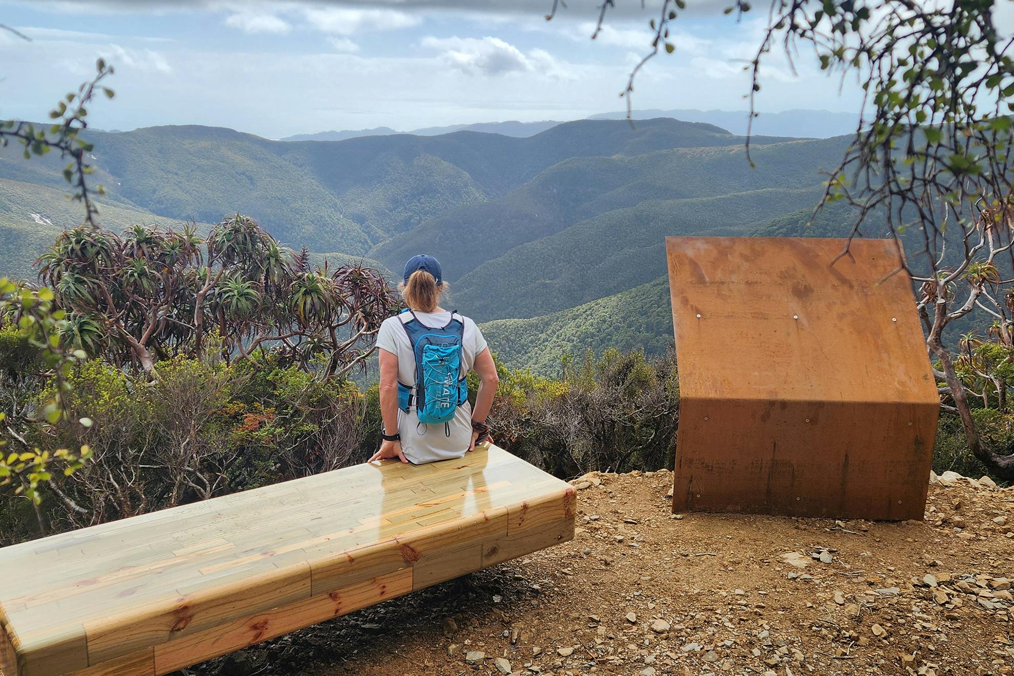
Roughly 8.5km from the start, after around three hours and close to 800m of elevation gain, you will reach the vent shaft viewpoint, where there is a comfortable seat with expansive views of Hawera (1190m) to the north, the leeside of the escarpment and Paparoa Track to the west.
The track then descends before climbing to meet the Paparoa Track 3.2km further on (1–1.5 hours). At the junction, turn left to Moonlight Tops Hut (5.4km) or right to Pororari Hut (12.9km).
From Pike Valley at 250m to the Paparoa Track junction at 950m, the track passes first through majestic old-growth beech and podocarp broadleaf forest, then beech and dracophyllum and ultimately stunted and wind-swept montane forest. The dappled light falling on verdant moss beneath tortured trees gives this upper section an ethereal feel.
The Pike29 Memorial Track showcases the beauty of the West Coast landscape and commemorates a tragic event.
- Distance
- 11.6km one way
- Total Ascent
- 1132m
- Grade
- Easy / Moderate
- Time
- 8–10hr return
- Access
- Pike29 Memorial Track car park, Logburn Road
- Map
- BT20
GPX File
- Pike29 Memorial Track (gpx, 13 KB)
GPX File
- Your device does not support GPX files. Please try a different device.