


- Distance
- 3km
- Total Ascent
- 659m
- Time
- 2-3hr to summit, 4hr return
- Grade
- Moderate
- Access
- From Rakaia Gorge onto Coleridge Road and then onto Algidus Road, or via Lake Coleridge village and Coleridge Intake Road to Algidus Road
- Map
- K35
- Notes & Map
- Peak Hill (pdf, 8 MB)
- GPX File
- Peak Hill (gpx, yo 9 KB)
- Your device does not support GPX files. Please try a different device.
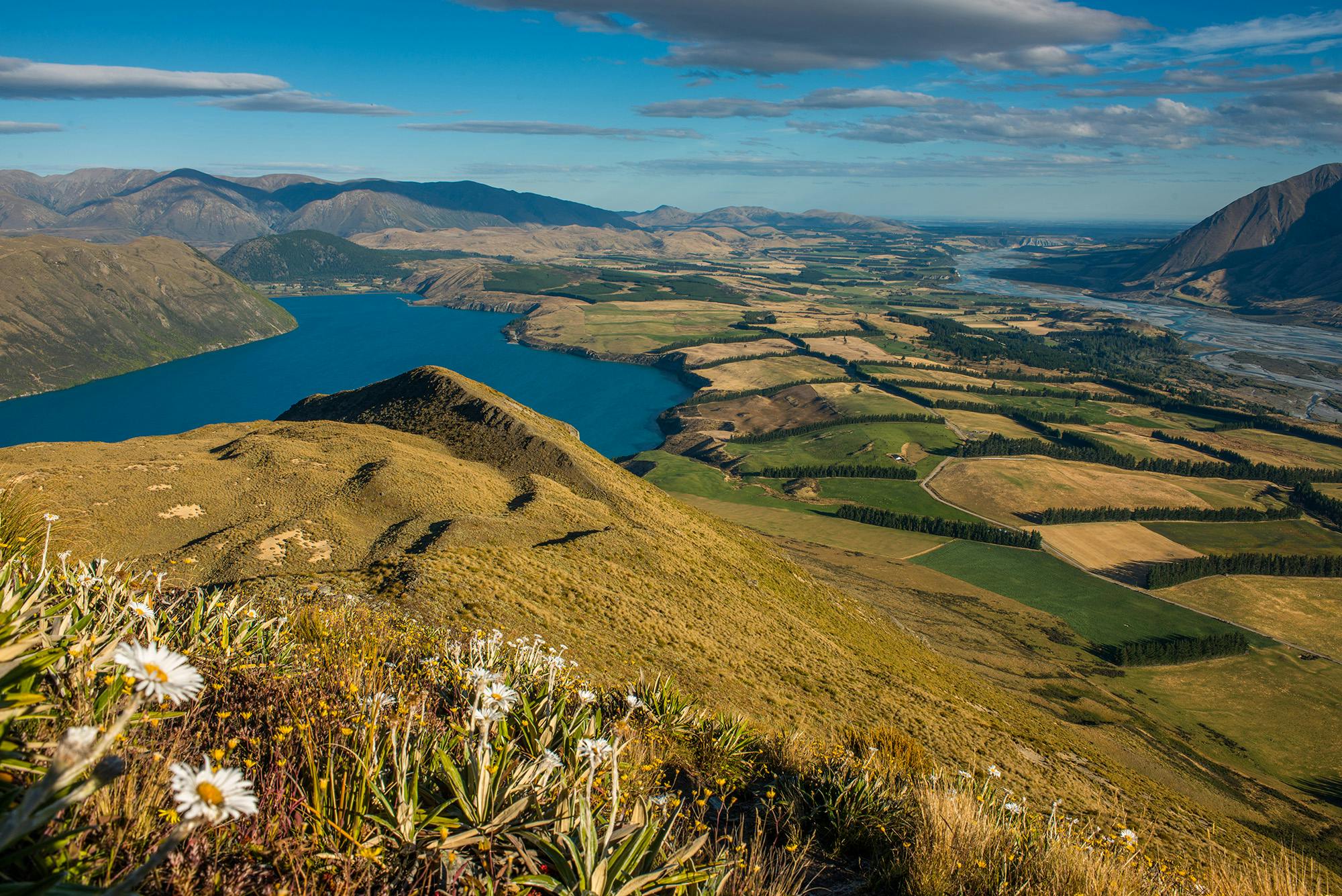
Peak Hill (1240m) is amongst the best foothill viewpoints in Canterbury. It has become a sought-after destination after years of seclusion as pastoral leasehold land in the backcountry surrounding Lake Coleridge.
The climb is steady, but not relentless and is well marked. With the passing of each waypoint, the views expand with the breadth of the landscape below.
Along the southeast ridge, the track winds in, around and over several small knobs before the final short push to the broad and indistinct summit. There is nothing uncertain about the view, though: Peak Hill stands between the Rakaia and Wilberforce rivers, which flow around its eroded faces and journey on towards the plains and sea. It can all be viewed from the summit ridge.
The ragged spine of the Alps, along with many intermediate ranges and valleys, lies not far off.
The view needs time to digest, so lunch on the summit is appropriate. Take plenty of water as there’s none there.
