


Around Ngauruhoe
This is not another account of a nose-to-tail march across Tongariro’s Alpine Crossing, but an alternative off-track adventure avoiding the crowds and visiting some hidden and untouched waypoints encircling Mt Ngauruhoe.
We followed the well-beaten track from Mangatepopo car park to just past Mangatepopo Hut, where we scrambled through hardy tussock to Hardmans Ridge.
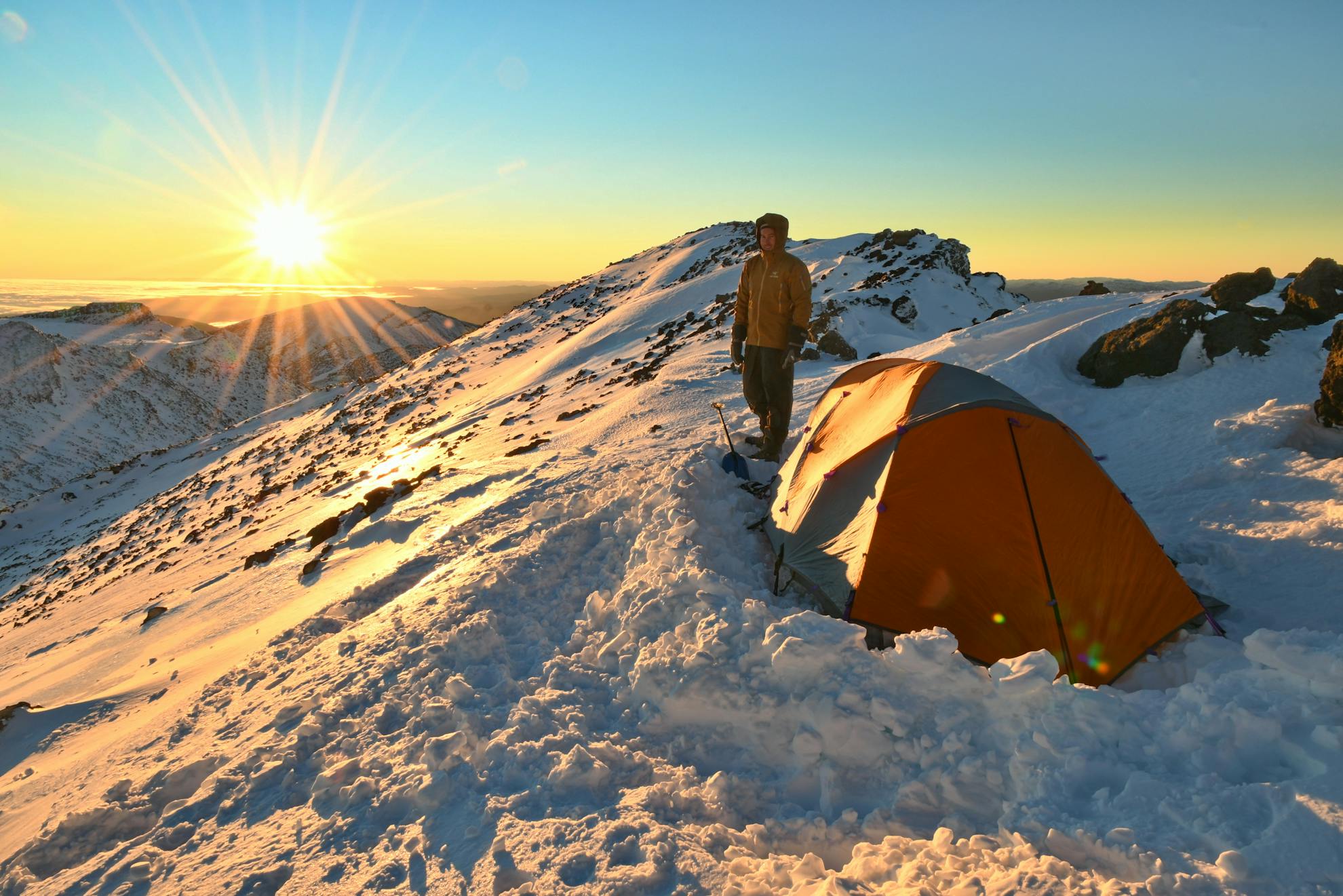
Following the ridge, the tussock gives way to scoria, rocky outcrops, wildflowers, and patches of snow. It was June and early winter snowfall had given Tongariro and Ngauruhoe a solid base. The weather was nothing short of spectacular, and the vivid contrast of deep blue skies, pristine white peaks, and green moss underfoot made for very satisfying hiking. From our vantage point, as we negotiated the ridge, a full panorama of Mt Ngauruhoe and Mt Ruapehu, and the interconnecting glacial valley, was an inspiring sight.
Tongariro’s summit loomed 300m above, and the gradient became steeper. We decided to take the direct route up a steep tongue of snow. Since it was north-facing, the snow was soft and we made it up without crampons. Peering over the summit ridge, the mountain showcased another vast scene: South Crater dropping away before us, Mt Ngauruhoe standing tall, Mt Ruapehu behind, and the distant snow-capped Ruahine Range on the horizon. Down at the foot of Ngauruhoe; a distinct line of ants marched onward.
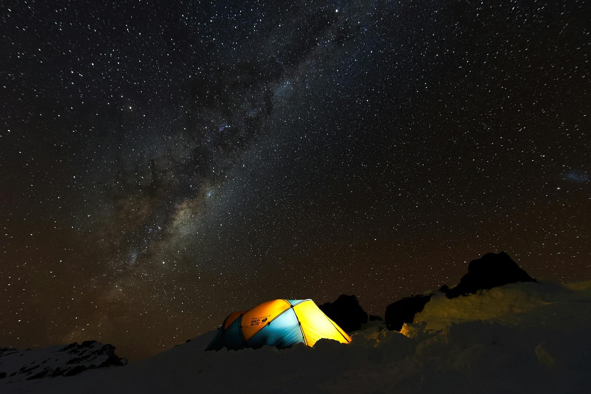
As the setting sun cast a pink hue over everything, we prepared our camp further along the Mt Tongariro Summit Route. The temperature dropped and by the time our tent was pitched and dinner was eaten, the sky was dark and we were alone. Looking up at the clear moonless sky, I was astounded by the billions of twinkling stars that encompassed the night sky. The Milky Way cast a bulging band of colour above our tent.
After breaking camp, we dropped down to Central Crater and climbed to a semi-frozen Blue Lake. We then backtracked to the Emerald Lakes and picked up the Tongariro Northern Circuit Track to Oturere Hut. Snow slowly gave way to the barren landscape of volcanic pumice, scoria, sand and ash. In the distance, Oturere Hut came into sight on a flat spot surrounded by tussock and overlooking the Kaimanawa Range.
After a night at the busy hut, we trudged southwest, starting with 3km on frost-covered scoria of the well-graded track to Waihohonu Hut, before deviating due west off-track down into a wide alluvial valley system.
An alluring ‘X’ on the map had caught my attention while planning this trip. Waihohonu Stream originates from the ground, although due to its remoteness it doesn’t get many visitors. We had received a tip-off that the LINZ topo map had it incorrectly marked, so we headed 700m further up the valley between Tama peak and Ngauruhoe in search of the source (BH35 2967 5944). Like an oasis in the desert, at the foot of a large lava flow and surrounded by lush vegetation, sparkling clear water bubbled up in a large pool. We stood there memorised by the rhythm of several cumecs of water appearing out of nowhere, then filled our bottles and continued our exploration up the desolate valley.
After 2km of easy walking over soft volcanic soil, we approached a prominent side-valley overlooking the Tama lakes. As we continued the circuit of Ngauruhoe, the soft soil transformed into large blocks of scoria, until we were scrambling over and through rugged formations of sharp black rock. This was the most demanding section, and on more than one occasion my tired legs tripped, resulting in bleeding palms.
We aimed for the saddle between Mt Ngauruhoe and Pukekaikiore, which is thought to be one of the older vents of the Tongariro complex.
From the saddle, we clambered warily down into the Mangatepopo Valley. After negotiating a small subalpine forest, we found ourselves back on the valley floor with a short walk back to the car park.
– Chris Coutts
- Distance
- 32.8km
- Total Ascent
- 1748,
- Grade
- Moderate
- Time
- Car park to Mt Tongariro, 3-4hr; To Oturere Hut, 3-4hr; To car park via Pukekaikiore, 6-7hr
- Accom.
- Oturere Hut $15 (off season) / $36 (in season), 26 bunks
- Access
- From Mangatepopo car park during off-peak season. Parking time limits apply at the car park
- Map
- BH35
GPX File
- Oturere Hut Via Hardmans Ridge.route (gpx, )
GPX File
- Your device does not support GPX files. Please try a different device.
