

A wonderful trip with incredible views and overnight options for hiking, mountain biking and ski touring.
Kopuwai Old Man Range stretches for 50km from the Fraser River in the north to the Umbrella Mountains in the south. The plateau is littered with fascinating rock formations, in particular Old Man Rock or the Obelisk. The views from the 1682m summit are sublime – in the right conditions, Rakiura Stewart Island, Aoraki Mt Cook and Mt Earnslaw can all be seen.
Much of this track can be undertaken in a 4WD vehicle, but the hike begins when the vehicle can go no further along Symes Road. A good spot to begin is at Mitchells Cottage, a historic stone house built by gold miners.
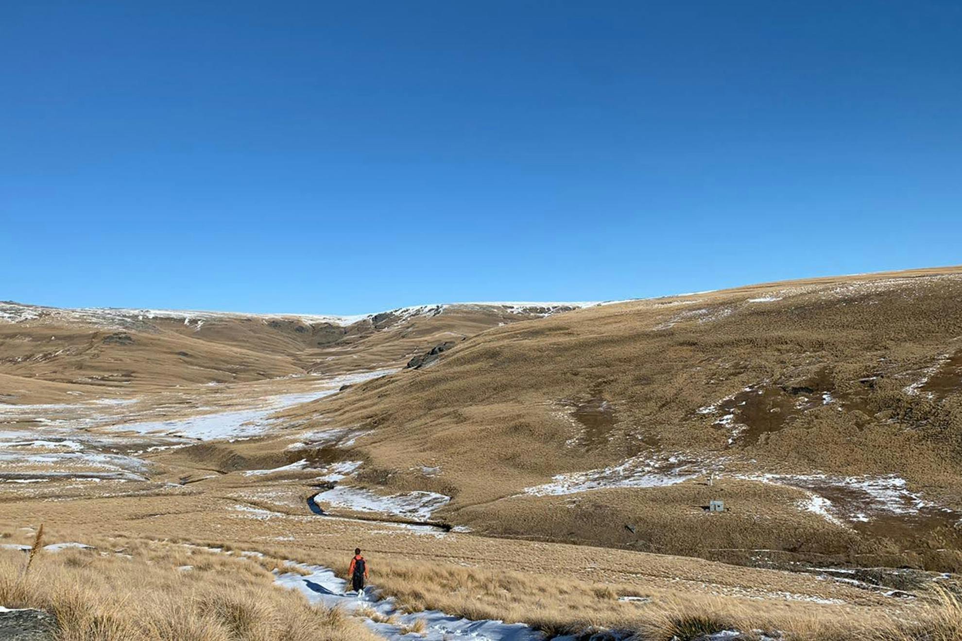
Walk along the road for around 8.5km as it passes through several farm properties, leaving gates as you find them. Eventually, views open up over the valley with the Clutha River Mata-Au running through. The scenery is typical of Central Otago: barren plateaus filled with schist rock formations over rolling hills.
Continue on Symes Road to the ridgeline and the beginning of the Kopuwai Conservation Area, a 20,000ha park dominated by large schist tors with dwarf tundra-like vegetation. An information panel describing places of interest stands at the beginning of the ridgeline.
Turn right here and follow the ridge towards the summit for 2.5km. You’ll pass several beautiful rock formations of which the most impressive is the 26.6m Obelisk. This is the highest point on the Old Man Range (1682m) and there are wide views of the Garvie and Hector mountains to the west, the Umbrella Mountains to the south and the Knobby and Hawkdun ranges to the east.
In winter, snow-covered cushion plants are exposed to high winds and there can be stunning snow drifts all over the ridge. The plateau is flat and easy going, but it is also open to the weather and care should be taken in all conditions.
Several tracks lead down from the summit. Continue north to join the Obelisk Loop Track, a 3hr return walk that also joins other tracks to descend towards Fraser Dam Road.
To reach Nicholsons Hut, retrace your steps to the ridgeline signboard and head west down Nicholsons Track for 30min, descending steadily into a valley where the hut sits on the far side of a catchment. Cross the small stream carefully to reach the hut. Nicholsons is an old musterer’s hut with interesting historical graffiti carved onto the walls.
- Distance
- 16.2km to hut
- Total Ascent
- 1251m
- Grade
- Moderate
- Time
- 4–5hr to hut
- Accom.
- Nicholson’s Hut (basic, 5 bunks)
- Access
- Mitchells Cottage, Symes Road, Fruitlands
- Map
- CC13
GPX File
- Nicholsons Hut via Obelisk (gpx, 97 KB)
GPX File
- Your device does not support GPX files. Please try a different device.