


Tantalising Titiroa
A distinctive peak in the Hunter Mountains, Mt Titiroa appears to have snow on it all year round due to the white granite sands that glisten on its summit.
We took a water taxi across the Waiau River and began walking the Hope Arm Track. Old beech and podocarp trees lined the muddy and swampy track – it is one of the few places that these tree types grow together.
We moved on from Hope Arm Hut through more beech and podocarp forest, to Garnock Burn Saddle and on through Snow White Clearings – a great place to camp if you have more time. We pressed on, descending to the river to commence the off-track section of the trip.
We climbed a ridge in the bush, keeping to the true right of the stream flowing from Mt Titiroa into the Garnock Burn and headed towards Pt785, avoiding the bluffs on the steep slope.
Above this, the gradient eased and we followed game trails to Pt1017 where scrub gave way to tussock slopes and a sandy granite saddle. Rain and wind whipped about the trees. Discussing our options to either camp in the bush or attempt to find a bivvy higher up, we chose to continue on as the squalls were coming and going and a low camp would make the next day longer.
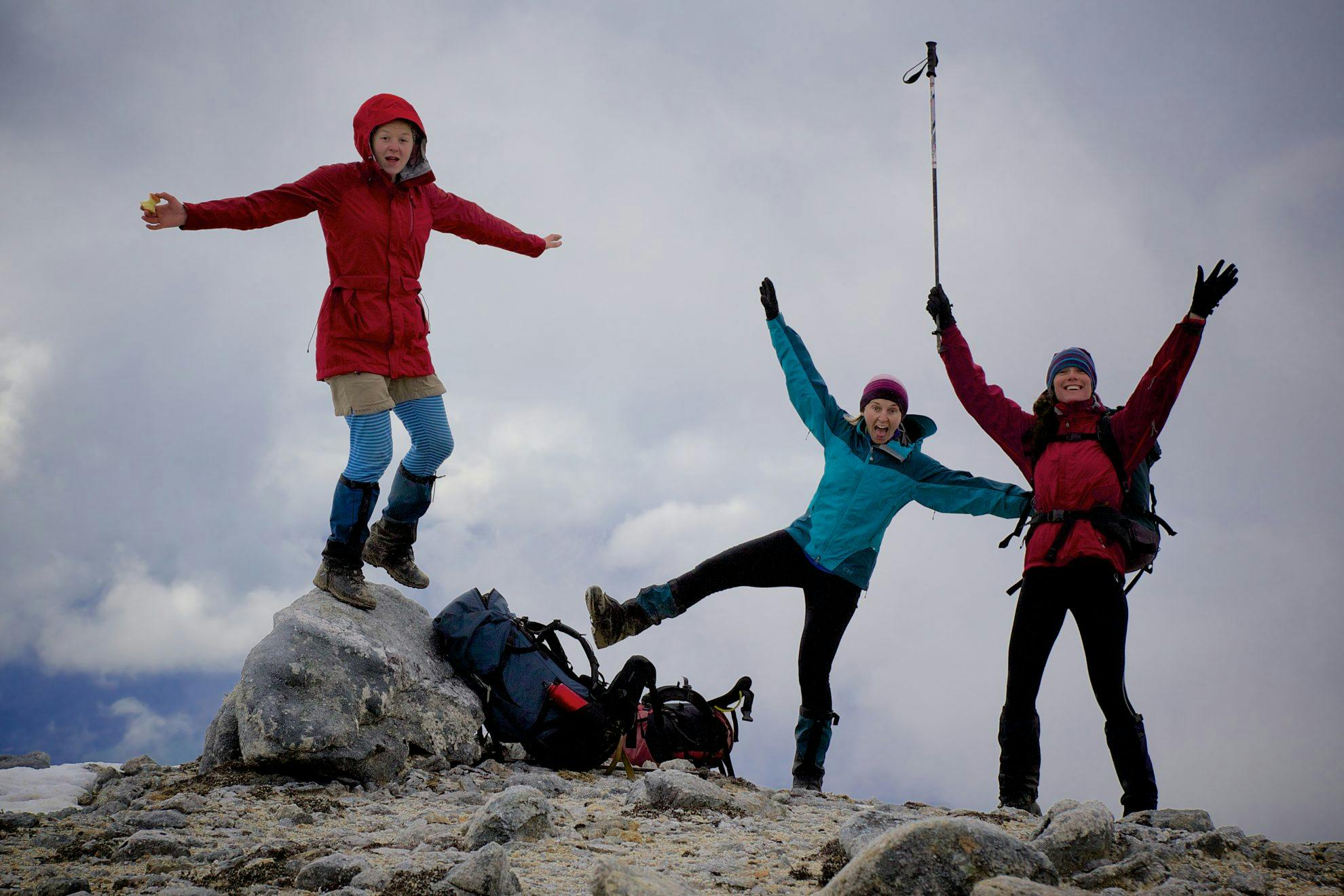
Celebrating views on the way down the ridge. Photo: Sarah K Smith
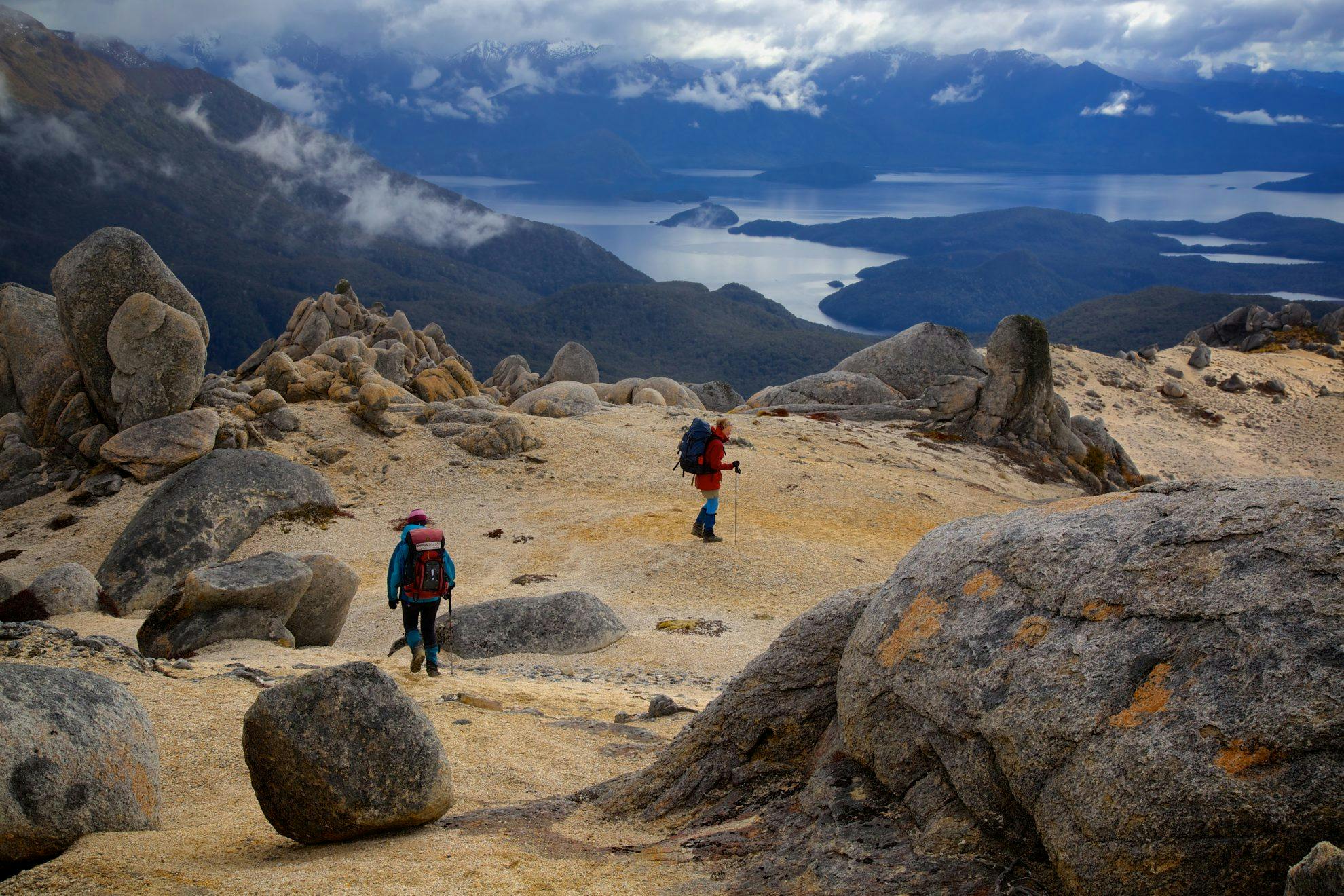
By late afternoon we found ourselves climbing the sandy slopes to the main ridge. The wind had subsided and we were greeted with a misty view of Fiordland. Cloud crept about the tops. Rainbows came and went. Eroded granite monoliths protruded from the ridge in various forms.
Much to our disappointment, a suitable bivvy remained elusive and we made do with a leaning rock, near a tarn 300m below the summit at Pt1412.
The next day we regained the main ridge and, stashing our packs under a granite boulder and marking it with a cairn, we began the climb to the 1715m summit. Occasionally we dropped onto the western side of the ridge to negotiate the more severe rocky outcrops. Our time on the summit was brief as heavy cloud rolled in.
Emerging beneath the cloud, a calm and misty blue Lake Manapouri came into view, the north ridge of Mt Titiroa leading the eye toward the lake. Wispy clouds shifted lazily, revealing and hiding different scenes. It was utterly captivating.
We then began retracing our steps, reluctantly, off the ridge, down to Garnock Burn, Hope Arm and our boat pick-up on the Waiau River.
– Sarah Smith
- Distance
- 19.3km
- Total Ascent
- 1984m
- Grade
- Difficult
- Time
- Pearl Harbour to Hope Arm Hut, 2.5hr; Hut to Bivvy at Pt1412, 5hr; Bivvy to summit, 1.5hr; Summit to Pearl Harbour, 9hr
- Accom.
- Hope Arm Hut ($5, 12 bunks)
- Access
- Pearl Harbour, Manapouri (boat trip required)
- Map
- CE07
GPX File
- Mt Titiroa (gpx, 42 KB)
GPX File
- Your device does not support GPX files. Please try a different device.
