


- Area
- Victoria Forest Park
- Distance
- 5.33km
- Time
- 8-9hr
- Grade
- Moderate
- Access
- Saddle Road off SH65 (Shanendoah Highway). Maruia Saddle Road leaves SH65 midway between Springs Junction and Murchison. The track starts after Culvert No 17 from the Maruia Saddle but is not obvious. Look for an orange triangular marker beyond a steep bank some 20-30m above the road.
- Map
- BS22, BS23
- Notes & Map
- mt-mantell-victoria-forest-park (pdf, 1 MB)
- GPX File
- Mt Mantell (gpx, yo 3 KB)
- Your device does not support GPX files. Please try a different device.
Starting out from Maruia Saddle Road, the track climbs through the bush towards the tops. The lower part of the track is marked but the forest has been damaged by wind and snow and many markers have been lost.
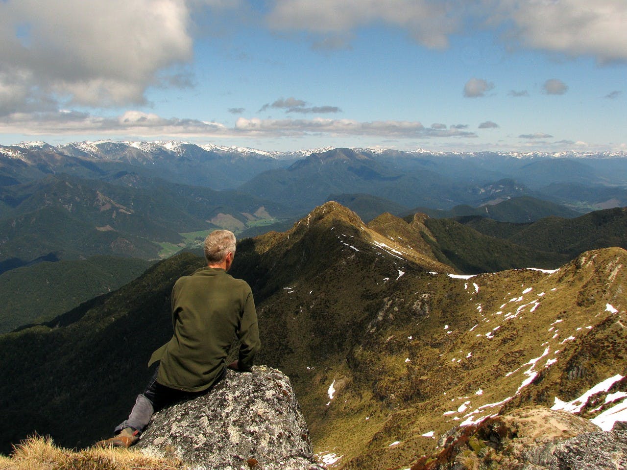
Higher up, the forest is more stable and the markers are easier to follow along a leading ridge.From the bushline to the summit is about 2km of relatively flat, non-technical ridge travel and once reached, the summit provides great views.
Mt Mantell lies between the Maruia and Matakitaki Rivers. Two hanging valleys drain the mountain. To the south-west the Shanendoah Stream flows through a flat valley before dropping off steeply towards Shanendoah Saddle. Taylor Stream also starts as a hanging valley and drains into the Matakitaki Valley.
