


- Distance
- 10.8km to hut
- Total Ascent
- 1350m (to hut)
- Time
- Te Rou Road to Mt Fell Hut, 6-8hr; To Mt Richmond, 2.5-3hr return
- Grade
- Moderate
- Accom.
- Mt Fell Hut (6 bunks, $5)
- Access
- From Te Rou Road
- Map
- BQ26
- GPX File
- Mt Fell Hut via Timms Creek Track, Mt Richmond Forest Park (gpx, yo 30 KB)
- Your device does not support GPX files. Please try a different device.
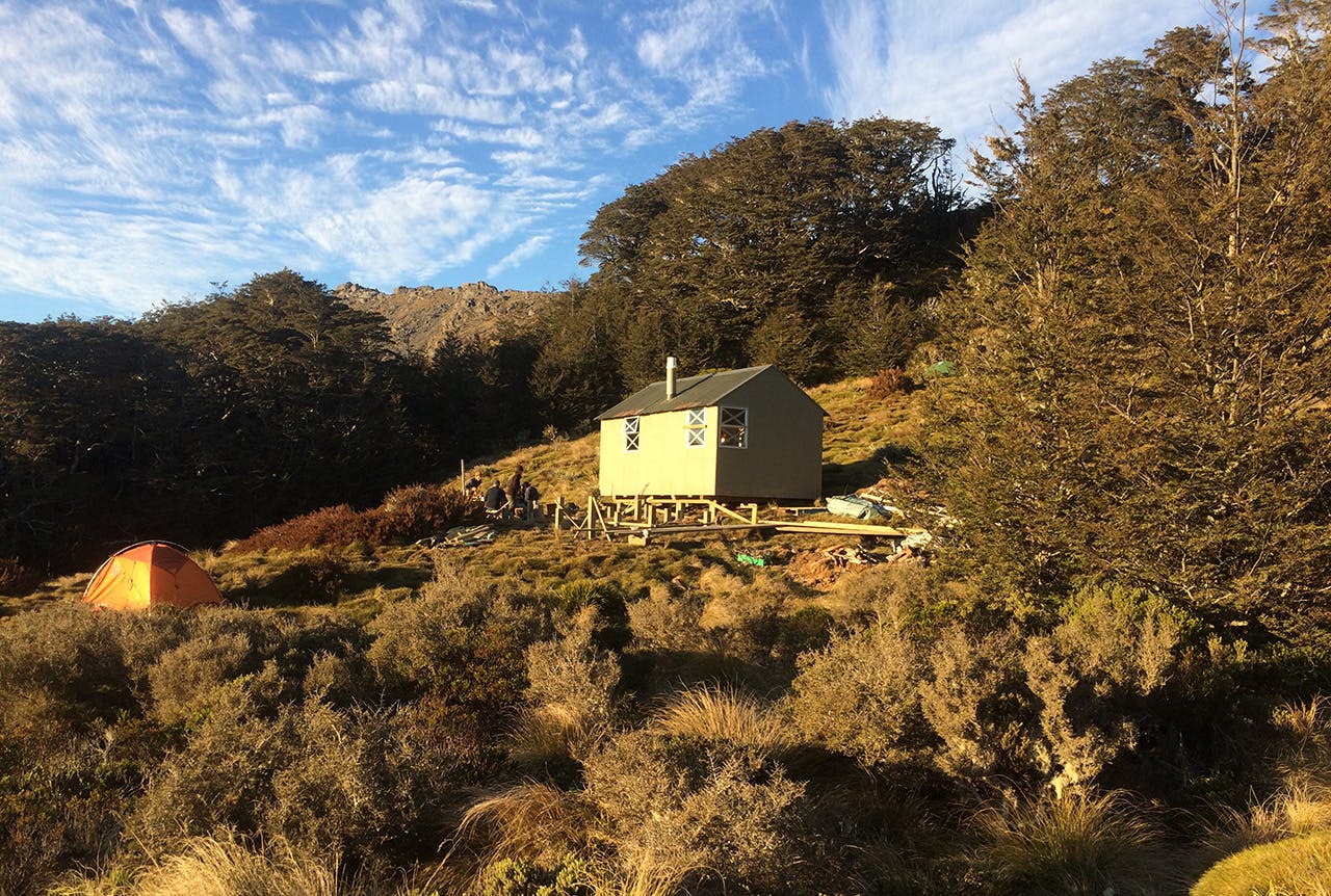
Mt Fell Hut is situated on the bushline, 1 km south of Mt Fell summit (1602 m), just below an alpine meadow. It’s well worth heading up to this meadow early to watch the sunrise. It was built in 1964, and moved and tidied up in 2017.
The track runs beside Timms Creek in the lower reaches. There is a clearing at Timms Flat, ideal for a picnic for those not carrying on to the hut.
At Timms Creek Fork is an unbridged crossing of a creek. This crossing can provide problems during wet weather. The track then ascends steeply, through through mountain beech and tussock to Mt Fell Hut.
Nearby Mt Richmond (1760m) is an accessible winter summit, and a good choice if the mountains further south have high avalanche loading. Mt Richmond is a solid but straightforward climb beyond the hut (although crampons and ice axe may be required, depending on conditions). For those who’ve made transport arrangements, a traverse is possible over the mountain to Richmond Saddle Hut, where a track leads to Top Valley.
