


More than a meander
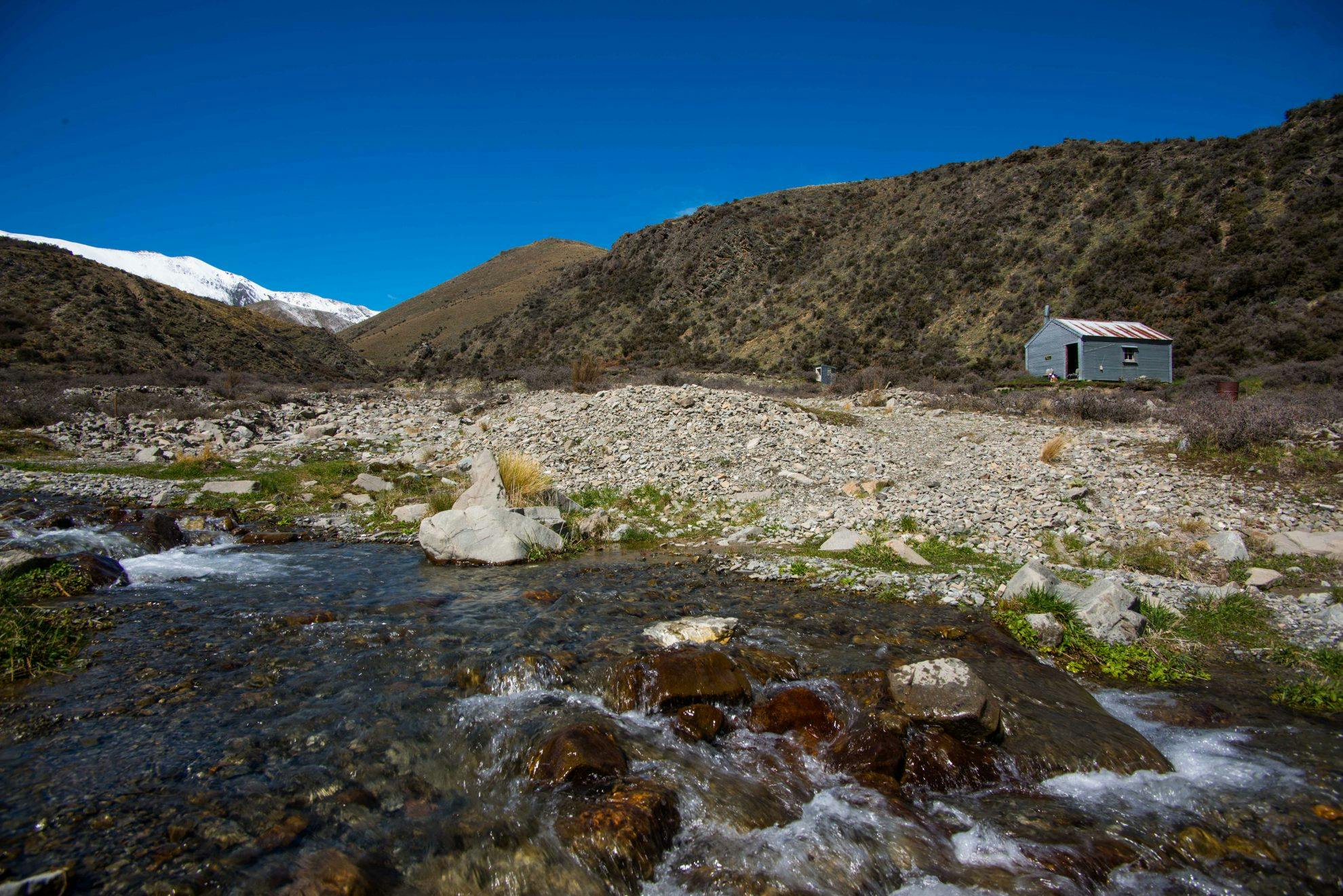
Tucked into a little corner of a high country valley, beneath the towering flanks of the Mt Somers Range, is an archetype of the rustic musterer’s hut.
Manuka Hut is easy to reach along a poled route from nearby Lake Emily – a modest body of water boasting an attractive wetland and grand views of the Alps.
It makes a perfect family tramp, especially one to take my daughter, Dominique, on. She has Down Syndrome, which puts many tramps beyond her capabilities.
If you have a 4WD you will be able to drive almost to Lake Emily from the Hakatere-Heron Road, saving about 45 minutes walk, otherwise cars can be left just off the road. Once at Lake Emily, the route continues along the vehicle track which climbs gently onto the broad saddle east of the lake.
At this point, there are grand views of the Arrowsmith Range. The track splits here with the rougher and higher route heading north-east over undulating terrain and through some small patches of matagouri before descending steeply onto the Stour riverbed. An easier, but slightly longer route continues south-east along the vehicle track to also reach the Stour River where it turns to the north to follow the river valley up to the hut. We chose the more direct route, but this section proved tough going for Dominique, especially where the trail diverges from the main poled route, along the 4WD track, and heads over a low spur, through scattered matagouri, to reach the Stour Valley. From there, it was another two kilometres to Manuka Hut.
The six-bunk hut looks directly onto the western face of the Mt Somers Range. Rising over 1000m above the hut and stretching in an unbroken wall for 10km in a north-south orientation, the range is an amazing spectacle. It can be reached from the hut by choosing one of the more open spurs that head east onto the large sloping tableland beneath the range.
Our second day was a pit day, to allow Dominque to fully rest before the hike out and to give me some time to explore the surrounding countryside. I made my way to Manuka and Seagull lakes, two shallow bodies of water that often completely evaporate in dry weather.
On our day of departure, the forecast nor’wester cranked up and was howling unabated around the hut and valley, black storm clouds were massing to the north and west, and it was cold and unwelcoming outside.
But by the time we turned the first corner around the Manuka Range, the wind was at our backs and a little while later, the sun was out.
- Distance
- 6.88km
- Total Ascent
- 292m
- Grade
- Easy
- Time
- Two hours to hut
- Accom.
- Manuka Hut (free, six bunks)
- Access
- Signposted off the Hakatere-Heron Road, just north of Maori Lakes
- Map
- BX19, BW19
GPX File
- Manuka Hut (gpx, 14 KB)
GPX File
- Your device does not support GPX files. Please try a different device.
