


- Distance
- 7.87km
- Total Ascent
- 287m
- Time
- 3hr
- Grade
- Easy
- Accom.
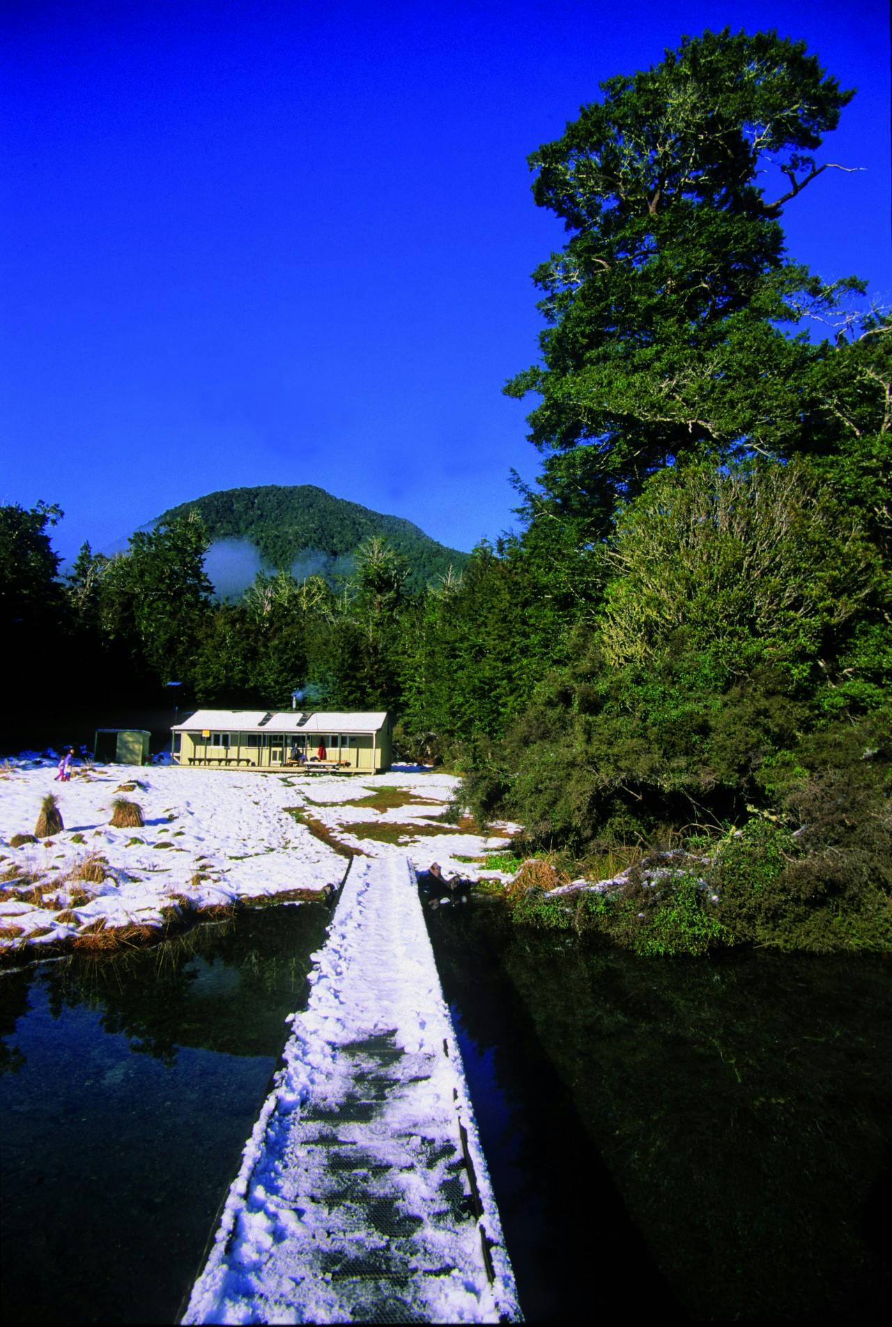
- Manson-Nicholls Memorial Hut (24 bunks, $15)
- Access
- From SH7, 5km east of Springs Junction
- Map
- BT23
- GPX File
- Manson Nicholls Memorial Hut, Lewis Pass Scenic Reserve (gpx, yo 17 KB)
- Your device does not support GPX files. Please try a different device.
With low-altitude (topping out at 580m), an easy forest walking track, little elevation and a jewel of a lake, this trip makes for an ideal winter tramp in all conditions. Indeed, it’s a fine introduction to winter tramping for young families.
At Marble Hill Campsite, there is a concrete wall constructed in the 1960s, right on the Alpine Fault. It’s there to establish a datum for measuring displacement following seismic shifts.
The track is well-graded on the way to the bridge overlooking The Sluice Box. This is a serene spot, just the place to listen to the gin-clear waters of the Alfred River as it squeezes through a cleft in the greywacke rock.
A formed tramping track continues, with occasional tree-falls, one unbridged stream (in normal flow stepping stones avoid wet feet), many boardwalks and a bit of mud. The track is a gentle and steady climb of around 130m through dense beech forest, following the Alfred River. Troll Bridge is the halfway mark to Manson Nicholls Memorial Hut (24 bunks, serviced), where there is a jetty and a composting toilet.
The hut was built in 1976 by Christchurch Tramping Club and Lake Daniells Fishing Club members. It is named in honour of Phillip Nicholls and Brian and Sharon Manson, who were killed by a landslide in 1974 while sheltering in the old hut on the opposite side of the lake. A fourth member of the party – Bonna Beattie, managed to row and crawl to summon help, but it came too late.
Lake Daniell occupies a glacially-eroded hollow between the Alfred and Spenser ranges. It used to be called Lake Daniells, but the Geographic Board changed the name in 2007.
