


Northland’s nerve wracking nose
One of the north’s best kept secrets, Duke’s Nose offers royal views of Whangaroa Harbour for the price of a 5-6 hour return slog. Reached only by a near vertical climb, it’s not for the faint-hearted, but the views are undeniable.
Beginning as a 4WD track, the first half hour is a viewless toil up to 180m, wherein the track thins as it crosses a saddle, and eases into a rooty descent.
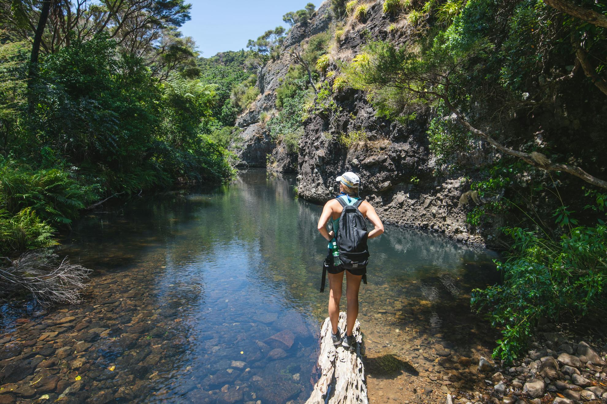
The downhill ends abruptly at the edge of the bushline where it meets a freshwater stream, flanked by an impressive rock wall. It’s the perfect spot for a cooling dip, and can be deep enough to fully submerge in parts.
A rock and branch bridge allows crossing in fine weather, but if you need to take your boots off, leave them off for a further 50m, as there is a second crossing.
From here, the track opens up and leads through a lush valley towards the harbour. Determined pohutukawa cling improbably to sheer rock, and sizable mangroves tower over the water’s edge. The surrounding bluffs give a sense of otherworldly isolation, as if by crossing the river, you have crossed into a land before motorcars and cellphones.
It’s easy here to let the mind wander back to a time when whaling and timber ships frequented the harbour – perhaps the most infamous being the Boyd, a brigantine whose crew and passengers met a grisly end in 1809 when all but a few were murdered and eaten by local Māori. Imagine the stories if the trees could talk.
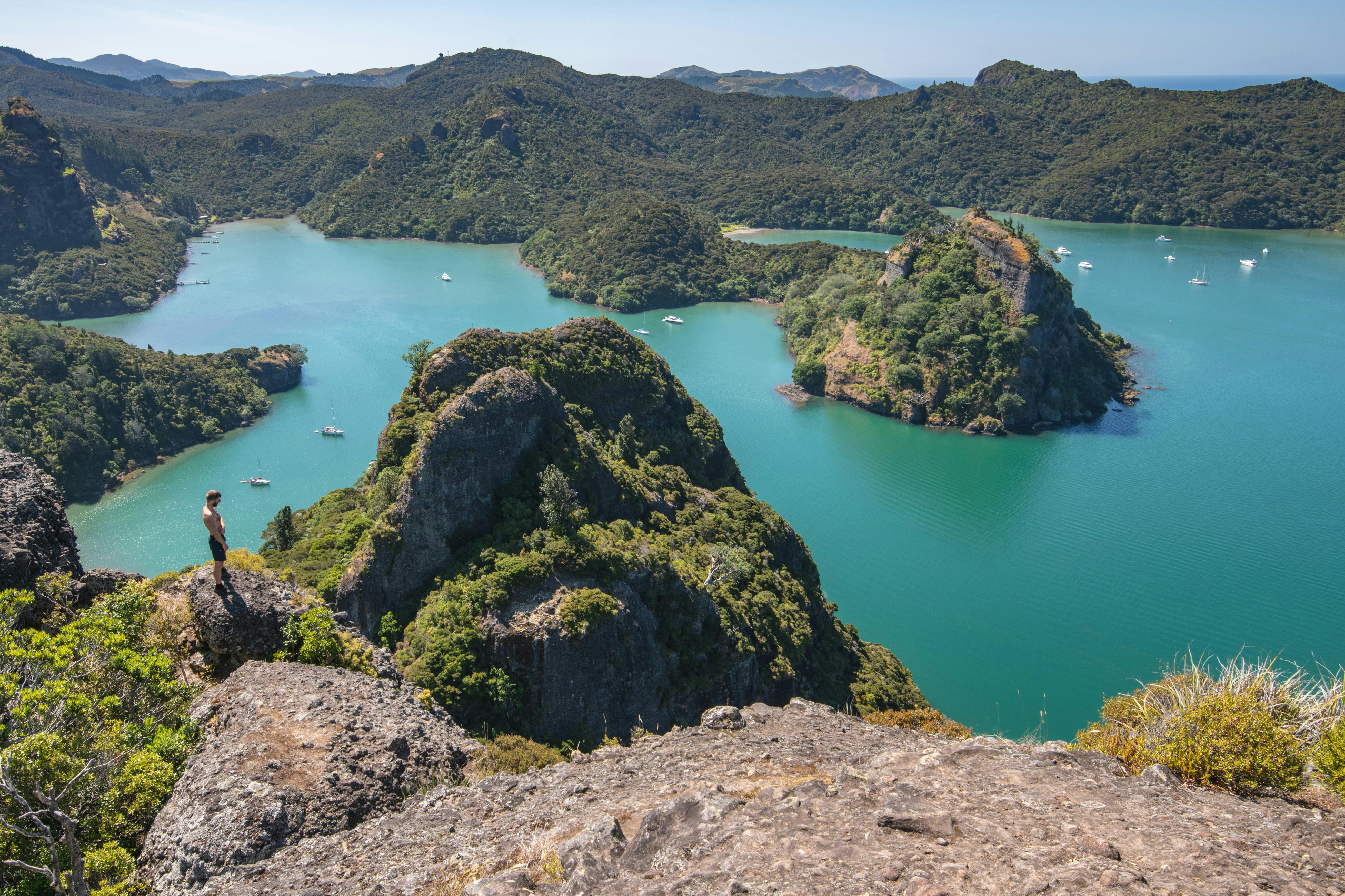
The route is undulating as it snakes east along the edge of the inlet, and at times is slippery underfoot. Coming around a point, Kairara Rock comes into view, and a worn, but overgrown, sidetrack leading to a clearing is worth the effort for quality views.
A few minutes later, Lane Cove Hut is reached. Prime real estate, the 16 bunk hut is perched right on the water’s edge, and is understandably difficult to book.
A DOC sign here estimates the 750m walk to Kairara Rock at an hour. While there’s no doubt it’s a steep and technical ascent, I made it in well under half that time.
The bulk of the summit track winds through manuka scrub in a consistent – but not overly steep – climb, but the best is saved for the last 50m, which is more rock climbing than tramping.
Two grab rails, recently installed by DOC, replace the old chains and provide sturdy and necessary assistance to the summit. Almost vertical in parts, confidence in your climbing ability is a must.
The 360-degree view from the summit is extraordinary. The coastline is a child’s scribble, seemingly random in its geography, and ancient volcanic bluffs erupt from native bush like a Thailand postcard.
Unruly terrain conceals Taupo Bay to the north-west and Tauranga Bay to the east, and the breathing mouth of the harbour plays open gate to the tides.
Every direction is a spectacle, and were it not for time restraints and the relentless sun radiating onto the volcanic rock, I could have easily spent hours here. Sadly though, I had to head back to the car park, all the while pondering my next visit.
- Distance
- 5.23km
- Total Ascent
- 409m
- Grade
- Moderate
- Time
- 5-6hr return
- Access
- From the Campbell Road end car park, Totara North
- Map
- AV28
GPX File
- Kairara Rock (gpx, 5 KB)
GPX File
- Your device does not support GPX files. Please try a different device.
