


- Distance
- 54.9km (approx)
- Total Ascent
- 4191m (approx)
- Time
- 5-6 days in good weather
- Grade
- Moderate/Difficult
- Accom.
- Camping at Theatre Flat, Parks Pass, Cow Saddle, Fohn Lakes, Dart River
- Access
- The walk begins and ends at the Routeburn Shelter.
- Map
- CA09, CB09
- GPX File
- five-passes-mt-aspiring-np (gpx, yo 97 KB)
- Your device does not support GPX files. Please try a different device.
The five Passes is a classic backcountry loop trip which includes the crossing of Sugarloaf Pass, Park Pass, Cow Saddle, Fiery Col and Fohn Saddle. This route is mostly off track and as such, the route drawn on the accompanying map and the GPX file is approximate only.
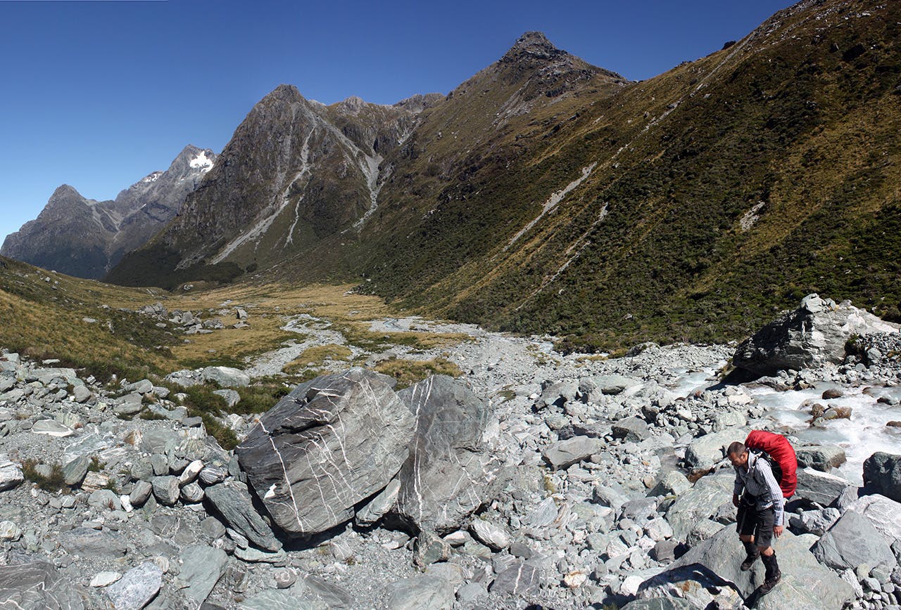
The route begins on the Routeburn Track but soon veers off, after roughly 500m, to head up Sugarloaf Track and over the first pass. It’s a steep descent form here into the Rock Burn, along a track lined with mossy beech trees and beside a tumbling creek.
Follow the Rockburn Track up valley, across the plains and to Theatre Flat where you might camp for the night.
Continue up valley to cross Park Pass into Hidden Falls Creek. Cow Saddle is the next objective, at the head of the creek.
From Cow Saddle, climb east and north towards the penultimate pass, Fiery Col, which at 1546m, is the highest point of the route.
An unstable scree slope leads to Fiery Col. The descent on the other side is over slippery rocks and alpine grass, and between the courses of two strands of Fiery Creek. Marvellous mountains stand as serrated sentinels, dominating the horizon.
Sidle around beneath Pts 1905, 1748 and 1774 and then climb to Fohn Saddle.
From Fohn Saddle it is a steep 500m descent to Beans Burn, a tributary of the Dart River.
Rock-hop downriver until reaching a rock bivouac, which looks like a small Neanderthal dwelling with three small ‘bedrooms’. Previous occupants have carpeted the floor with straw and made a wall from sticks to keep out the wind. Charred walls arch over a fireplace, and there’s a frying pan and an axe to chop wood.
Carrying on downriver, weave between tussock tufts and into confusing strands of beech forest which may require waist-deep wading through ferns. A flat is eventually reached, offering a campsite under the face of Mt Chaos.
Near the flat, a tumbling creek marks a seemingly invisible path to Lake Unknown, a destination few appear to visit. Reaching the lake requires an off-track scramble up steep slopes packed tightly with centuries-old beech forest. It’s rumoured that the 1.5km ascent takes five hours when approaching from the Dart River side.
If your trip does not include a side trp to the lake, continue on the Beans Burn track until it reaches the Dart River. Follow the river back to the Rock Burn and over Sugarloaf Pass the car park.
The Five Passes route is most often described in the reverse direction of that described here. We chose this direction due to running a story about it in our December 2016 issue.
