

Carl Walrond looks at whether the Tararuas deserve their stormy reputation
From the promontory that is Wellington, roads fork up the Kapiti Coast and over the Rimutaka Range to the plains of the Wairarapa. The fork is caused by the Tararua Range – an 85km spine that rises to 1500m.
Residents of the Kapiti Coast gaze up to the tops where 20 times as much rain may fall as where they live. A rain gauge on Angle Knob gets 8-10 metres a year. Much of this rain gets into the eastern river systems of the Wairarapa – the Waohine, Waingawa and Ruamahanga among others.
‘For sheer miserable monotony of contour, rigour of weather, and bleakness of outlook it is hard to beat the Tararuas,’ wrote John Pascoe in his 1952 book Land Uplifted High. ‘It is no defence for the Tararuas to say that they have their fine days. As with shrews, their nicenesses are unpredictable.’
The tops have storm conditions for around 200 days in the year and are clear for around 80. But clear doesn’t necessarily mean calm. Sitting at the edge of the bottleneck of Cook Strait, prevailing westerlies are squeezed through in a north westerly flow.
The range is a fiendishly efficient rain-catching system. Rivers in South Westland have up to 50 floods a year. Tararua streams average around 80 – making them, in the words of one hydrologist, “the most aggressive rivers in the country”.
The steep range is perfectly angled to milk moisture from prevailing north westerlies. While over the long term a typical Tararua river’s flow levels resemble exchange rate fluctuations, weekly recordings are more akin to a cardiac meter – a blip flowed by a decay to a stable level before the next blip. Blips are peak flows caused by passing frontal systems. In-between violent gales and sudden downpours are periods of benign weather.
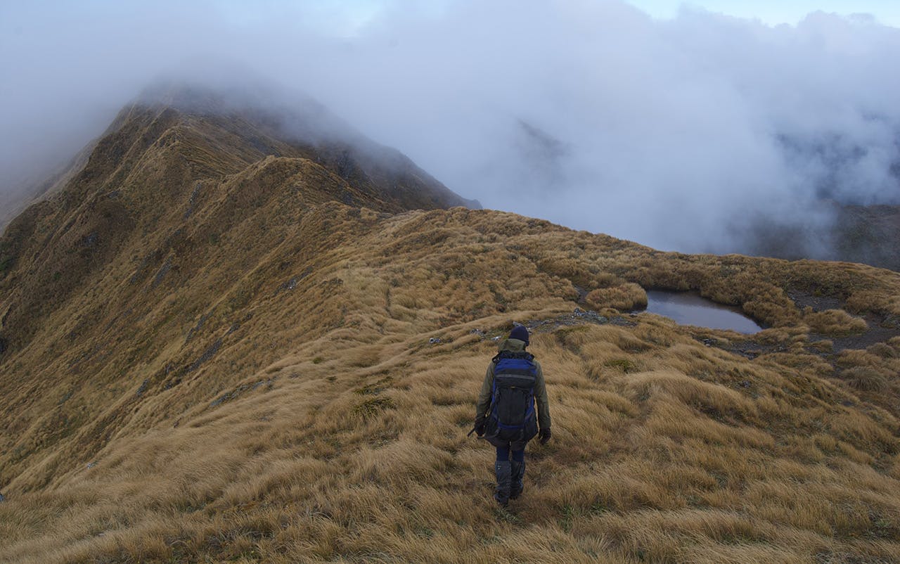
It was against this background that I set out test the Tararua’s reputation with Karl Beckert, a seasoned Tararua tramper, 10 years younger, but with greater experience of the ranges, than me.
Walking up Waingawa Valley he regales me with tales of alpine travel in screaming southerlies. I counter with a tale of benightment.
Years earlier a mate and I had tried to do the Tararua Peaks. Domestic leave passes must be negotiated beforehand and once commitments from two families are taken into account there are few free weekends – you don’t wait for a weekend with a good forecast, you just go. And go we did, in the face of a marginal outlook. With visibility down to a few metres we did a small circle around the area where Seddon Bennington would later perish. We gained the ridge, but just before the steel ladder, my partner was blown off his feet. It was too dangerous to go on so we spent a night in our sleeping bags inside our packs in the leatherwood – just 20 minutes from Maungahuka Hut. We retreated in nor’westers and rain.
Others will have similar stories. Chris Maclean’s book, Tararua, gives an account of an east to west range crossing attempt. Planning to walk along Renata Ridge, Maclean’s party only realised they were on the Southern Crossing upon stumbling on the war memorial cross on Mt Hector – 3.5km off course.
Escape routes off ridges are an important consideration. On my trip with Karl we ascended Middle King in morning murk, having arrived at the biv in light rain just on dusk the previous evening. It was clagged in at dawn, but we left around 7am to see what it was like on the tops. If it was really bad, our bail-out option was back down the ridge we had ascended, or we could also turn to South King and then to Baldy. (Baldy used to be called Baldhead because it is often free of cloud while the main range is not.)
We headed south for about 50m. Then the clag lifted – we were on its edge. West was cloud and east was clear.
“You’re not tempted?
“Yeah let’s do it”.
The next five hours we followed our initial plan and navigated with map and compass to North King, Adkin, Girdlestone, Brockett and Mitre. Often gaps would appear and we could see the whole ridgeline. Standing on Mitre (1571m), the Tararua’s highest (and no doubt windiest) point, three hours later you could have dropped a feather.
Descending to Mitre Flats 20-minutes later, the southerly hit. A weather pattern had coincided exactly with our plans. If we had been up on Middle King any earlier we would have bailed down Baldy. We found the shrew rather tame – for five hours at least.