


Gaining a summit is a highlight of any trip. But why just stop at one when you can add two, three or more summits to make your next tramp one to remember. These nine trips will do for starters.
Words and images by Shaun Barnett, Pat Barrett and Ray Salisbury
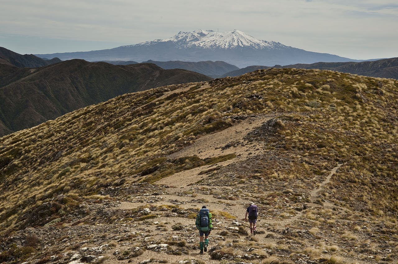
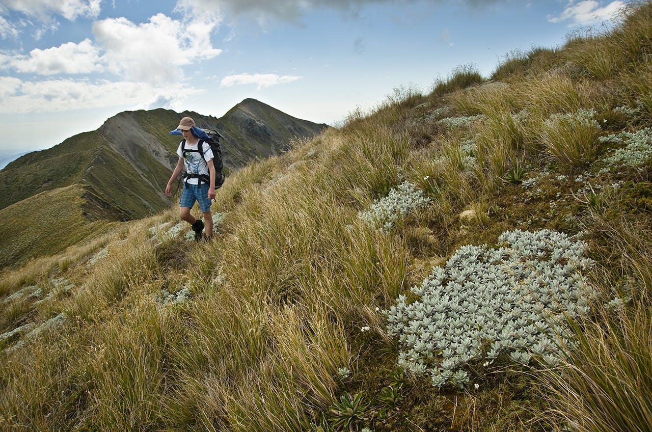
Tongariro traverse
Ngauruhoe-Tongariro-Tahurangi, Tongariro National Park
Tongariro National Park’s three distinctive mountains draw summit-seekers, and some climbers like to tackle all three peaks in one day. A more leisurely option is a weeklong tramp around the park, bagging the major summits en route.
Take the track from Whakapapa Village to Mangatepopo Hut, then join the Tongariro Alpine Crossing to the impressive amphitheatre of South Crater. From here, a well-trodden route climbs the northern flanks of Mt Ngauruhoe (2287m), followed by an exhilarating scree-run back down. At Red Crater, take a side-trip along the ridge to Mt Tongariro (1967m), before descending to the Emerald Lakes, and down into the Oturere Valley and Oturere Hut.
Past Waihohonu Hut, continue south on the Ruapehu Round the Mountain Track, with Rangipo and Mangaehuehu huts for shelter en route. Divert off the main circuit to Blyth Hut, and head off-track to Turoa ski field. From there, the suitably equipped and experienced can tackle a direct ascent of Tahurangi (2797m) the highest of Ruapehu’s several peaks. Its summit overlooks the surreal landscape of Crater Lake. Traverse around the lake, past The Dome (2672m, bag it if you’re keen) and down the Whakapapa Glacier to end at Whakapapa Village. By then, you’ll have climbed the three main summits, including a traverse of Mt Ruapehu, and tramped the length and breadth of the park.
Number of peaks Three Time 6-8 days Grade Moderate, except for Mt Ruapehu where mountaineering skills are required.
Epic Westland views
After climbing all those peaks, Kiwi Flat Hut will be a welcome rest stop. Photo: Neil Silverwood
Mt Durward-Mt Neville, Westland
In South Westland the weather and conditions are often as wild as the mountains. Add to the mix the Waitaha Valley – legendary for its fantastic scenery and awe-inspiring landscape – and you have a trip offering plenty of adventure.
This particular trip is within the abilities of most fit trampers and begins from the end of Waitaha Road on the east side of the valley where a new track has been cut beside the Waitaha River, past Morgan Gorge to the swingbridge at the toe of Kiwi Flat.
From the flat, a steep, marked track heads into the hanging basin containing Scamper Torrent and its beautifully set and remote hut. Behind the hut, to the south, a complex route can be followed through scrub and tussock, crossing several large fault scarps, to reach the slopes below Mt Durward (1929m). Ascend easily to the summit for a mighty view of the Westland Alps, plains and rivers, and a tantalising route along the Smyth Range to Mt Smyth (1855m), Mt Neville (2036m) and Mt Barry (2074m).
This ridge traverse is one of the best in Westland and, provided the weather is in your favour, holds no unpleasant surprises. In fact, it’s relatively easy and offers fascinating and spectacular views into both the Waitaha and Wanganui headwaters, as well as onto the Garden Of Allah Ice Plateau and the fearsomely steep Lord Range peaks.
A high camp could be struck at numerous points along the ridge, to allow more time to be spent here to enjoy the grand panorama. The summits themselves are modest ascents with the best descent route being from The Attic, west of Mt Neville, down Headlong Spur, which has a track on its lower section, back to Kiwi Flat and its hut.
Number of peaks Four Time Three days Grade Moderate.
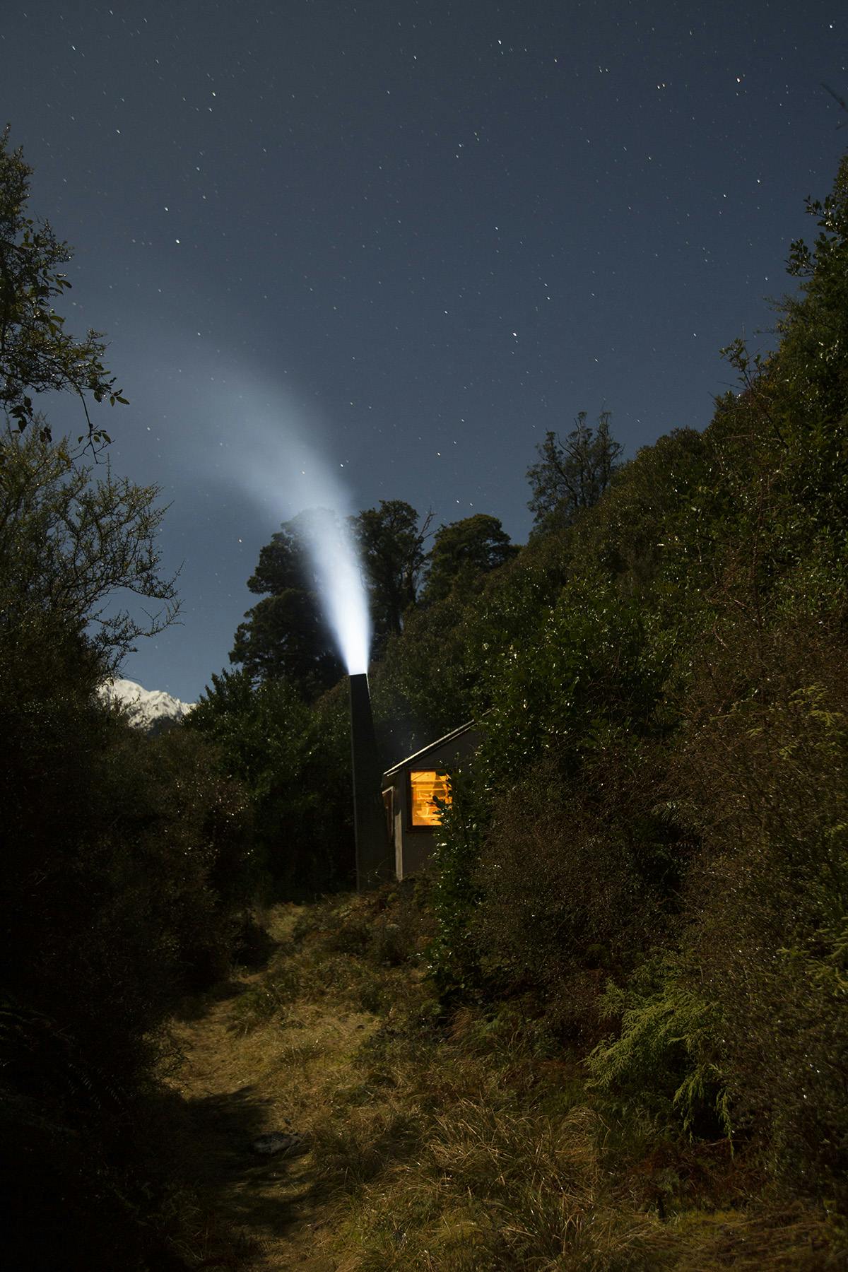
The Tararua’s ‘must do’
Tarn Ridge Hut offers accommodation for peak baggers. Photo: Shaun Barnett/Black Robin Photography
Northern Crossing, Tararua Forest Park
A Northern Crossing was first completed early in the 20th century, and has since become a ‘must do’ trip in the career of any self-respecting Tararua tramper. On a good day this crossing offers travel over tussock tops with views from coast to coast and just enough challenge to satisfy the keenest.
Beginning from the Ohau River, near Levin, the route splashes upstream to South Ohau Hut before tackling the grunty Yeates Track to Te Matawai Hut. Beyond, the peak-bagging begins: first up is Pukematawai (1432m), followed by Arete (1505m), the first of several peaks over 1500m. The diminutive Arete Hut lies on a tussock shelf below.
Beyond, an unmarked route heads towards the Waiohine Pinnacles (1470m), with a short diversion possible to bag Lancaster (1504m). After the excitement of traversing steep slopes around the Pinnacles, Tarn Ridge offers flat travel to the superbly located Tarn Ridge Hut. Beyond is a peak-bagging frenzy, with Girdlestone (1546m), Brockett (1538m), Mitre (at 1571 the highest peak in the range) and Peggys Peak (1545m). A long descent leads to Mitre Flats Hut, from where the Barra Track leads out to the road end.
Number of peaks Seven, including six over 1500m Time Three days Grade Moderate-difficult (navigation skills required).
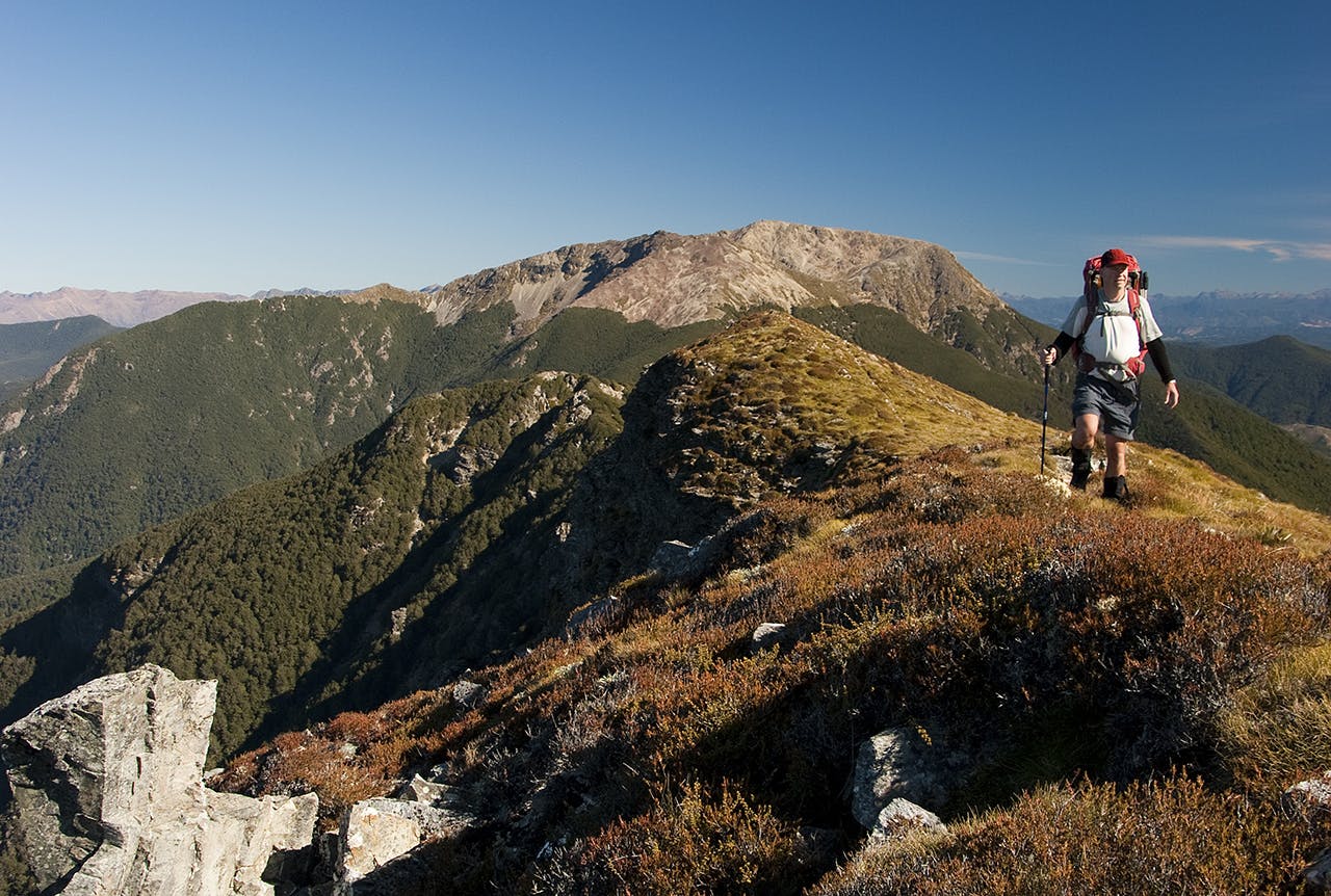
The St James with a twist
Faerie Queene-Una-Gloriana, St James Conservation Area
In the heart of the Lewis Pass region, the Spenser Mountains rise like a giant wedge separating the upper Maruia and Ada valleys from the Matakitaki to the north. The principal summits on this section of the range, Gloriana (2218m), Faerie Queene (2236m), and Mt Una (2300m) can all be climbed over 3-4 days by accessing the lower slopes along the beautiful St James Walkway. This excellent track, with its comfortable huts, makes for a grand introduction to the region and an easy approach walk to the base of the peaks at around 900m.
Camera Gully, north-east of Ada Pass, is the best route for both Gloriana and Faerie Queene and both could be ascended in a day from either Ada Pass Hut or a camp at the base of the gully. From the head of the gully, a climb, bypassing bluffs, to the large alpine lake beneath the summit of Gloriana is the best route. From the western side of the lake, climb the south-west ridge to the summit and a grand view of the Lewis Pass and Nelson Lakes. This is a stunning region and all the more so when viewed from on-high where the tapestry of landform and colour is truly memorable. (Note, access to the south west ridge is guarded by ice fields and requires crampons and ice axes.)
The best route to Faerie Queene is along the ridge, but you could also drop onto the tarn bench to the north and follow this east until below the west faces of Faerie Queene. A descent from the summit into Camera Gully can then be made over Pt2192m and down a broad face which later becomes a shoulder above the gully. Take care with bluffs when dropping into the gully.
Mt Una is a more difficult climb which could be made after a night at Christopher Hut and then via the Christopher River into a series of high basins to the ridge crest west of the summit. This ridge can prove to be a challenging ascent.
The beauty of these climbs is that they can easily be incorporated into walking the full St James Walkway and thereby adding a vertical component to this easy tramp through magnificent mountain country.
Number of peaks Three Time 4-6 days Grade Difficult.
Just like the South Island
Trampers descend from Junction Top with Ruapehu in the distance. Photo: Shaun Barnett/Black Robin Photography
Umukarikari-Waipakihi-Middle Range, Kaimanawa Forest Park
When I showed a friend a photo of the Waipakihi Valley, he thought it was in the South Island. There’s certainly a grand open nature to the valley, with a lazy river meandering through pleasant flats, and great beech-clad slopes rising to significant tops.
None of the summits on this trip are hard – indeed many are rounded – but you’ll cover a great swathe of excellent tramping country. Beginning from Kaimanawa Road, head up the steep track onto the Umukarikari Range. Traverse Sharp Cone (1481m), and Umukarikari (1591) on undulating, barren country with snow poles leading the way and mountain views in all directions. Descend to Waipakihi Hut, nicely situated on a terrace above the Waipakihi River. From here, follow a cairned route to Junction Top (1605m), then traverse south along the Middle Range, ticking off Te Raketuangiangi (1605m) and the distant Thunderbolt (1633m). Here, the Middle Range bends westward to end at Motutere (1646m).
Take the Thunderbolt Track to the Waipakihi River, and camp at the base of the Urchin Track. Urchin (1392m), your last summit, is reached on a steep track before the final descent to Kaimanawa Road.
Number of peaks Six major Kaimanawa summits Time 4-5 days Grade Moderate (exposed tops and navigation skills required).
Mission possible
On the Alpine Route traverse. Photo: Ray Salisbury
The Alpine Route, Mt Richmond Forest Park
Once part of local tramping mythology, the Alpine Route is now an infamous section of the Te Araroa Trail. Not that it’s particularly crowded – far from it. People are thinner on the ground here than is the air swirling around Mt Rintoul. This is a demanding circuit that sports seven small huts and seven big mountains. This tops trip begins and ends in the bush, but for the most part, dances along the tussock and scrambles along shattered ridgelines – perfect for peak bagging!
From the trailhead on Wairoa Gorge Road, the first three hours are straightforward valley travel to Mid Wairoa Hut. A steep climb ensues to gain the tops, and Tarn Hut. (Mt Richmond Forest Park is spotted with huts like a zitty teenager. They are nearly-identical NZFS S-70 designs, named after their namesake mountains.)
First on the climbing itinerary is Bishop’s Cap – a perfect pyramid of rock that stabs into the sky at 1425m. With this bump behind you, there is a string of summits aligned from west to east. Next on the agenda is Purple Top (1532m) where a cairn balances atop the red rubble.
Past the diminutive dolls-house of Mt Rintoul Hut it’s a scramble up the shattered scree slopes to Rintoul’s summit cairn at 1731m. After topping out, drop down a poled route, with shingle slides providing dubious access to the bushline. This is the crux of the trip, and parties have been lost in the mist here for days.
A rather random maze of chutes and guts leads upward onto the sharp, unstable rock debris of Little Rintoul (1643m). To reach the shelter of Old Man Hut, descend a shingle slide on the east face to the bushline. This welcome refuge is snuggled next to a tarn, well off the ridgeline.
Probably the most delightful travel is through stunted beech on a carpet of moss and leaf litter, along to the tussock top of Old Man (1514m). While adventurous, there’s nothing too scary or airy. Snow poles lead down to the bush edge and onto the sloping alpine herb fields of Ada Flat. A handful of unnamed peaks are traversed across to Slaty Peak (1544m) and its namesake hut.
Large orange lollipop markers lead into a forest trail toward the saddle which links with Mt Starveall (1511m). Here, stupendous views are enjoyed of the Waimea Plains and the entire Arthur Range beyond. Then, a serrated spur of slabby schist drops in a dress circle to Starveall Hut. From this final vantage, a track descends abruptly in a series of switchbacks through broken beech, boulder-hopping along Hacket Creek to Hacket Hut, and the road-end.
Mission accomplished!
Number of peaks Seven Time 4-5 days Grade Moderate-difficult.
Arthur’s Pass double
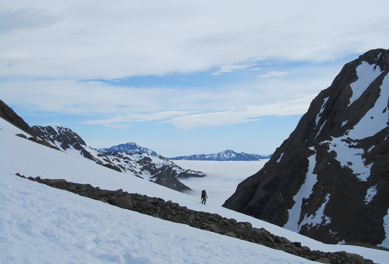
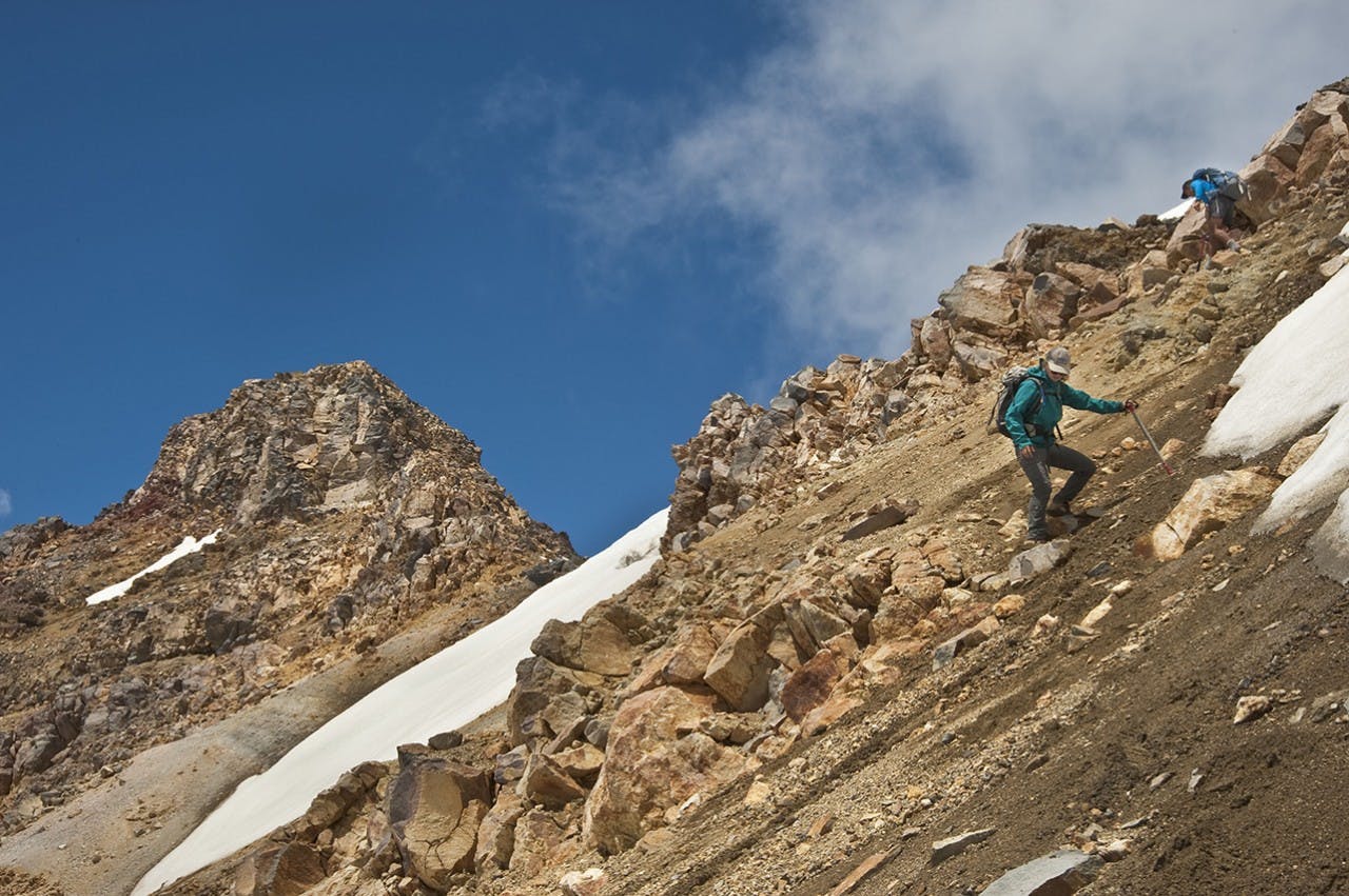
On Waimakariri Col, facing the Rolleston Valley. Photo: Christy McKellar
Waimakariri Col-Mt Armstrong-Anderson Peak-Hunts Creek, Arthur’s Pass National Park
The crossing of Waimakariri Col (1800m) in Arthur’s Pass National Park is a classic trans-alpine tramp undertaken by many enthusiastic groups each year and can normally be completed in a weekend. This variation adds a couple of nearby summits – Mt Armstrong (2110m) and Anderson Peak (1840m) – and an alternative exit route to the commonly-used Rolleston River.
Waimakariri Col is reached via the Upper Waimakariri River from Waimakariri Falls Hut or via the Rolleston River Track from SH73 just south of Otira. Both routes, as they are mostly untracked, will take a full day to reach the col. However a fit party could reach it in 4-6 hours from the Otira side in good conditions.
Once on the col, the peaks can be accessed by climbing the small glacier east of Armstrong to its summit. In late summer and autumn this route may be cut by shrunds, necessitating a much steeper and more exposed approach to the summit and a rope may be required.
From the summit, descend to a small col to the south into a gully which drops to the north-west below the summit ridge and around to the pass between Armstrong and Anderson. It is an easy climb along the ridge to Anderson Peak. From this second summit, head north to Pt1605m on Barron Ridge and then pick a route into the head of Hunts Creek and onto Hunts Creek Hut and Saddle. From the saddle, use the Kellys Creek Track to reach SH73.
Once in Hunts Creek, after dropping off the Barron Ridge you could ascend the opposite face and onto Hunts Ridge to reach the Taipo Valley via the well used route down Dry Creek. It’s an interesting and exciting route to the West Coast side of the Alps.
The route over Mt Armstrong will require ice axe and crampons, reasonable snow conditions to ascend the small snowfields, and good visibility. There is another option available if you do not wish to traverse Mt Armstrong and that is to head on down the Rolleston River to where the main valley track begins on the true right. Climb from here back up onto the ridge descending north from Mt Armstrong and over to Lake Florence and then to Anderson Peak.
This moderately challenging route offers huge views of Arthur’s Pass and the West Coast along with a great diversity of landscapes with the possibility of a high camp at Lake Florence or in upper Hunts Creek.
Number of peaks Two Time 3-4 days Grade Difficult.
Tarns and peaks
Tarn and Mt Technical, Lewis Pass tops. Photo: Shaun Barnett/Black Robin Photography
Lewis Tops, Lewis Pass Scenic Reserve
The Lewis Tops are some of the most accessible and idyllic in the country.
From Lewis Pass, the Lewis Tops Track climbs through stunted beech forest to reach the undulating, tarn-strewn tussock tops. Easy travel (poled at first) leads towards The Apprentice (1678m), the first summit to bag. Nearby Mt Technical (1870m) poses more of a challenge; its north and western ridges offer steep scrambling, but there’s a sneaky, more straightforward, way to the summit up a scree slope on the south-west side. Follow ledges back to the tarns beneath The Apprentice, and here traverse Lucretia (1643m) before tramping along to Brass Monkey Biv, set in a pleasing basin beside tarns.
From here, you can link a series of ledges and benches to the Rough Creek Track, which leads to the Lewis Pass Highway. However, mountaineers with the right gear might like to stay longer and attempt The Grand Duchess (1703m) or Mt Hatless (1660m), both of which are worthy summits guarded by bluffs.
Number of peaks 3-5, ranging from 1600m-1800m Time 3-4 days Grade Easy-difficult (depending on peaks climbed).
A circuitous route
On the tops, heading to Ranioteatua with Three Johns behind. Photo: Shaun Barnett/Black Robin Photography
Sunrise Hut-Waterfall Hut-Waipawa River, Ruahine Forest Park
This interesting circuit takes in some of the more spectacular peaks of the Ruahine Range, and visits some nicely located huts en route.
Begin on the well-graded track to Sunrise Hut, where beyond a route leads onto the tops at Armstrong Saddle. Views of the Tongariro mountains unfold before a taxing ascent of Te Atuaoparapara (1687m) with giddy views down its spectacularly eroded eastern flanks.
Descend to Waipawa Saddle, where you can divert to Waikamaka Hut for the night, or continue on and camp.
Pioneer tramper Norman Elder took three schoolboys tramping here, and named the peak Three Johns (1569m) after them. It’s reached on a short climb from Waipawa Saddle.
Beyond, a minefield of spaniard-infested slopes leads to Rangioteatua (1704m), with easy open travel beyond to Pt1715m (although unnamed, it’s the Ruahine’s second highest summit). Rugged travel ensues, weaving through bluffs to Paemutu (1682m) and Broken Ridge.
Descend into Tussock Creek, which leads into the Kawhatau River to eventually reach Waterfall Hut. From there it’s a straightforward tramp over Rangi Saddle to Waikamaka Hut, Waipawa Saddle and the car park.
Number of peaks Five significant Ruahine summits, including the second highest in the range Time Three days Grade Moderate-difficult
