


A Nelson Lakes loop that takes in three magnificent passes. By Jo Carpenter
An early summer front had dusted the peaks surrounding Maling Pass in snow, and drizzly clouds hulked over the Waiau Valley. But, despite the uninspiring weather, I felt the familiar stir of excitement that heralds the start of a trip into unfamiliar terrain.
The parents of my partner, Theo, had been envisioning this trip for more than a decade. Our planned loop would encompass three mountain passes, the almost mythical Blue Lake, and the untracked reaches of the Upper D’Urville Valley. Finally, the trip Julie and Andy had been dreaming about was coming to fruition.
The Waiau Valley offered easy river travel. We wove through stands of beech forest and open grassy clearings until the rust red roof of the new Waiau Hut appeared through the trees. Despite being completed only a couple of weeks prior, the hut book was already filled with entries from eager (or beleaguered) Te Araroa Trail walkers. We pushed on for a campsite that would put us within striking distance of Waiau Pass.
The valley slowly narrowed, shuttling us through glades of beech forest and over lumpy scree fans that originated high on the slopes above. Suddenly, there was a pained shriek behind me. I turned to find Julie sitting at the base of the scree, clutching her knee. The unstable stones had turned beneath her feet, tearing her knee alignment. While she could still hobble, things didn’t look good. It was with downcast faces that we pitched camp and pondered what to do next. After much hand-wringing, it was decided that Julie and Andy would walk back to the vehicle while Holly, Charly, Theo and I would continue. Caution was the better part of valour, but it was dispiriting for us all.
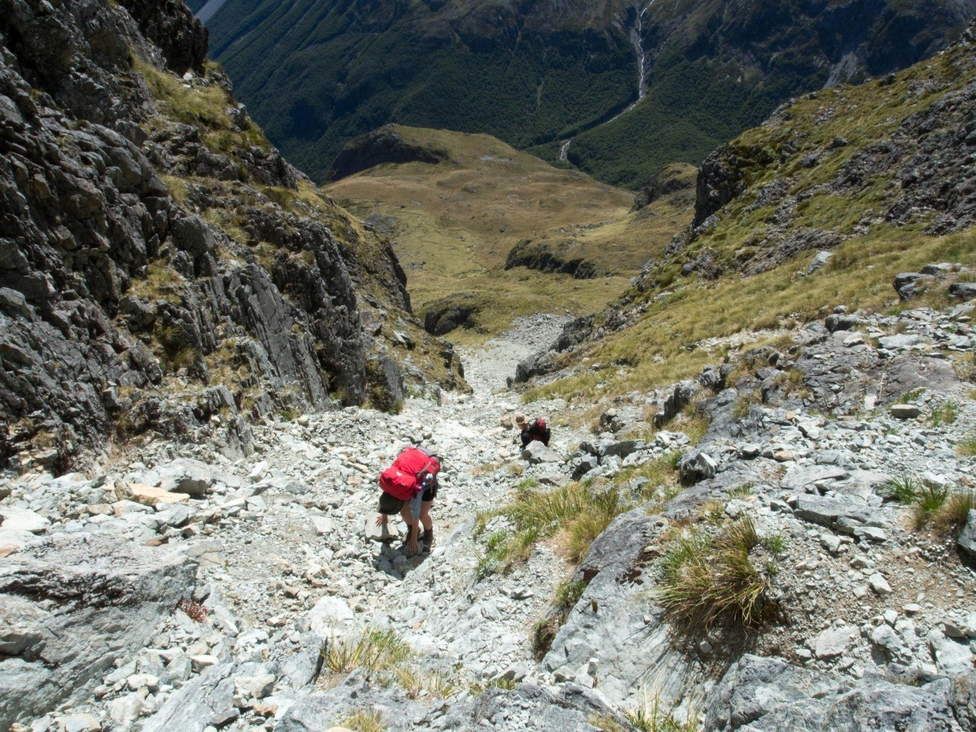
With bittersweet feelings, we continued our climb towards the base of Waiau Pass. We broke out from the bush into the stunning upper valley, filled with tumbling streams and colourful subalpine scrub. The track over the pass seemed to take a nigh-on impossible route through steep bluffs and then vanished from sight against the skyline. Tiny figures edged their way down through the cramped contours. With some trepidation, we began slogging our way up.
Packs that had previously seemed manageable suddenly succumbed to gravity, and I rapidly became lathered in sweat. At 1870m, Waiau Pass would be the highest point of the trip. After navigating a steep tussock face, the ascent became an enjoyable scramble up shelves of sun-warmed rocks. Drifts of snow provided excellent snowball ammunition.
We stopped briefly at the pass to enjoy the views into the Sabine Valley, with Lake Constance gleaming in the distance. There is nothing quite as inspiring as travelling over a high mountain pass and seeing a new valley open up before you, rich with possibility.
With aching knees, we descended 500m to the valley floor. We were greeted by a profusion of summer blooms and a family who were setting up camp among the tussock at the southern end of Lake Constance.
Our pace slowed as we navigated the bluffs that fringed the head of the lake, eagerly contemplating the rest that awaited us when we set up camp on the rocky saddle at its northern end. I was particularly excited for my first glimpse of the ethereal Blue Lake.
A short walk over the saddle the next day revealed views into the bush-clad Sabine Valley, with Blue Lake directly below. Glimmering in the morning sunlight, the lake exceeded my expectations. Shards of sapphire, crystal goblets, and uncut opals came to mind. The lake has become increasingly popular since it ousted Te Waikoropupū Springs as the clearest body of freshwater in the world, and the hut boasted a newly built warden’s quarters to help deal with the increase in trampers.
After refilling our water bottles, we made quick progress towards Moss Pass from where we would descend into the D’Urville Valley. With the pass appearing as a series of crimped contour lines on the map, we were curious how difficult the route would be.
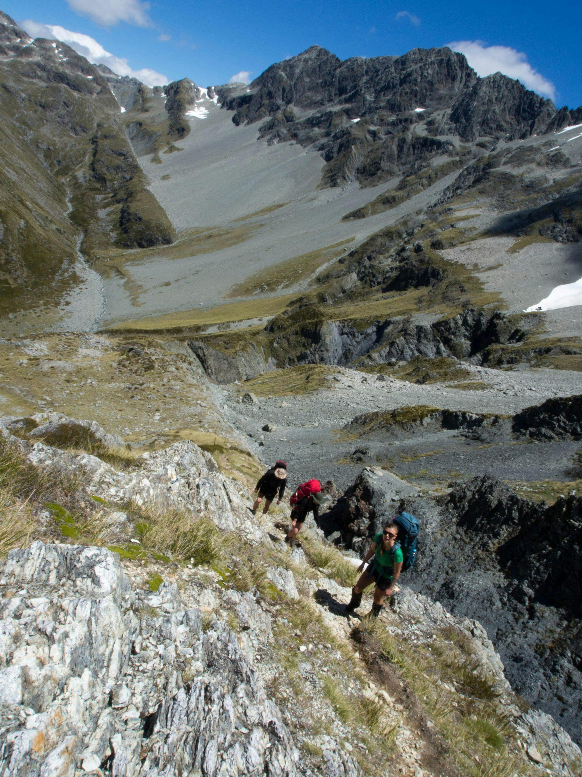
A gentle ascent into the tussocky basin revealed a narrow scree chute against the skyline, dotted with snow poles. The route turned out to be an exposed scramble over frangible rocks. We stepped tentatively, careful to avoid knocking rocks onto people below. Several times my feet skidded on the desiccated scree, flooding my veins with adrenalin as I struggled to regain secure footing. Finally, we reached the comparative comfort of the broad, rocky saddle at the zenith of the pass. The beech-cloaked spine of the D’Urville Valley lay a knee-destroying 1000m below.
It turned out that the innocent-looking beech forest hid the real steep stuff. Water was scarce and the summer heat made for sticky progress. The sound of Holly and Charly’s voices became increasingly distant as Theo and I clambered downhill, eager for a dip in the river. With relief, we reached the D’Urville River and sluiced ourselves in its icy current.
The map depicted a benign five kilometre wander up valley to Upper D’Urville Hut. Surely that wouldn’t take too long, we thought. The DOC signpost stated three hours, which gave me faint flickers of unease. Sure enough, an overgrown track that wove in and out of soggy gullies made for slow travel.
It wasn’t until the last rays of sunshine pierced the peaks above that Upper D’Urville Hut appeared through the trees. We were tightening the guy lines on our tent when Holly and Charly trudged into view half an hour later.
Motivation had ebbed the next day. Holly had a headache, Theo’s Achilles heels were giving him grief, and my blisters were rupturing. Why hadn’t we factored in a rest day? Who thought a pass every day was a good idea? Why had Theo and I thought this trip was going to be easy? But our internal grumbles diminished as we eased into the route towards Thompson Pass.
Expecting the track to end soon, we started travelling up the riverbed. Then Theo spotted another orange triangle in the bush. To our surprise, the track continued onto the river terrace before starting a steady climb through a beech forest fragment. After 20 minutes of upwards travel, we realised with dismay that this must be a track cut towards David Saddle that wasn’t shown on the map. A scratchy bush-bash along the contour line brought us out into the graceful fans of the upper D’Urville and back on route, slightly frustrated at the dogleg we’d taken.
An elegant crown of peaks ringed the upper D’Urville. We followed a tussocky spur towards Thompson Pass, carefully picking our way around clusters of hostile speargrass. A tramper we’d met earlier in the trip mentioned the scree near Thompson Pass was bare and clayish, forcing him to cut steps to ensure safe travel. With this warning in mind, we were relieved to find a relatively straightforward slope ahead of us, with a reassuring amount of grit on it. The scree gave way to broken sheets of rock, festooned with alpine herbs and woolly edelweiss flowers, which rapidly plateaued onto a beautiful stony saddle.
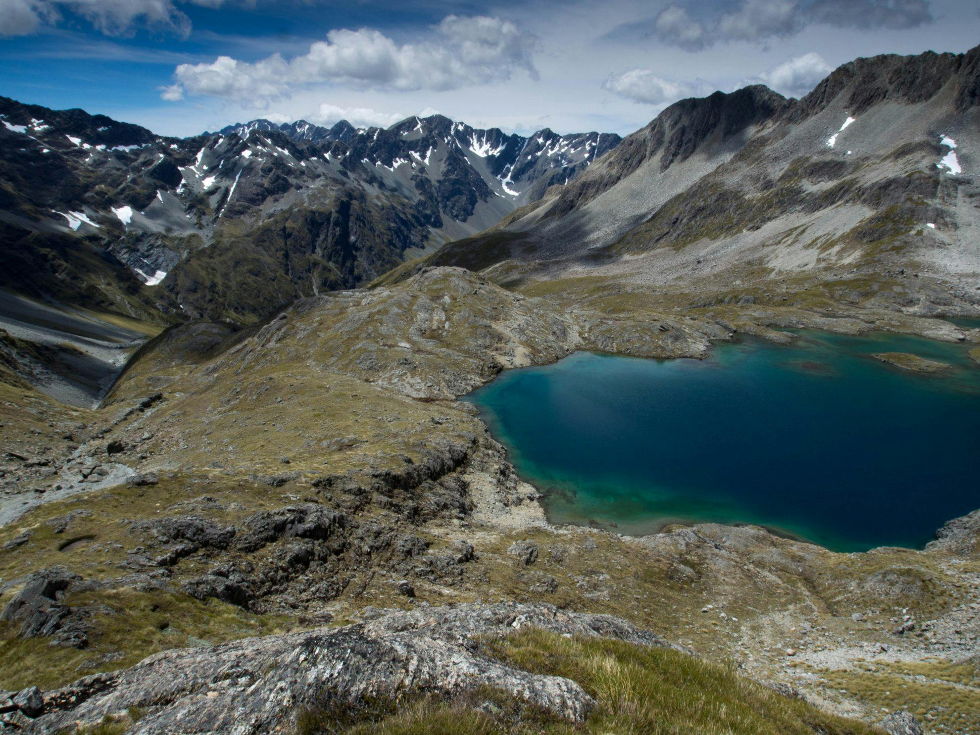
By some happy metamorphosis that most trampers will be familiar with, all my physical niggles faded into the background as I drank in the view. The upper Waiau stretched out before us, with the route to Waiau Pass just visible as a silvery seam running through the rocks. Below us lay the jewel that is Lake Thompson, its turquoise shallows darkening to royal blue as the water deepened. Rolling tussock hills encircled the lake, keeping it company on its lofty perch. It offered tempting camping opportunities but we were won over by a delightful looking spur that descended into the valley. With sunshine on our heels, and the last of the passes behind us, we made a sprightly descent towards the familiar turns of the Te Araroa Trail.
Our sprightly striding had morphed into jaded trudging by the time we reached our campsite on a picturesque river flat near Caroline Creek Biv. The Land Cruiser waited for us an easy two hour’s travel down valley. As I wolfed down a meal of noodles, I contemplated the days behind us. On reflection, a pass a day wasn’t such a bad idea – actually, it had been a great idea. The long days, dried sweat, sunscreen lacquer, and blisters were all worth it. And now we had the perfect excuse for another epic trip, with Andy and Julie in tow.
- Distance
- 52.5km
- Total Ascent
- 3471m
- Grade
- Moderate / Difficult
- Access
- 4WD access over Maling Pass into the Waiau Valley
- Map
- BT24
GPX File
- Nelson Lakes 3 passes (gpx, 82 KB)
GPX File
- Your device does not support GPX files. Please try a different device.
