


New huts, tracks, a park and ride and a gondola are among the developments proposed for two iconic national parks.
DOC is proposing a more hands-on approach to managing national parks which may change how Kiwis experience these places forever.
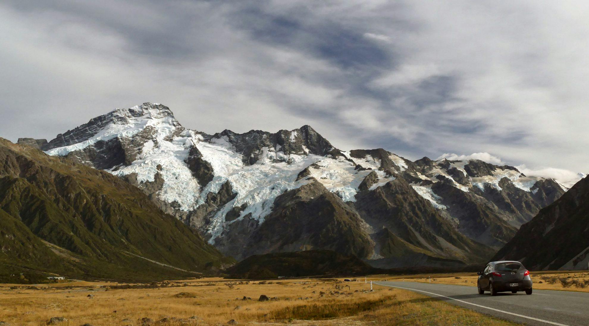
The department is consulting on draft management plans for Aoraki/Mt Cook and Westland Tai Poutini national parks to manage a swathe of new challenges.
Both parks are facing unprecedented growth, catering for close to a million people a year. Climate change is also forcing a rethink around how people experience the country’s highest peaks.
How DOC addresses these issues is likely to influence the plans for Fiordland and Mt Aspiring national parks, which are overdue to be reviewed.
Here’s what trampers need to know.
The biggest change proposed is a park and ride for visitors heading to Mt Cook Village. With nearly a million people visiting the park each year, the White Horse car park is regularly overflowing and visitor numbers are expected to double in the next 10 years.
Under the proposal, a car park would be built at Birch Hill and buses would shuttle visitors into the park during peak times. A new campground could also be near Birch Hill to cater for campervans.
Aoraki operations manager Brent Swanson said it is possible visitors would be charged to use the park and ride, but a decision would be made at a later date.
FMC president Peter Wilson said he only supports the idea if it is free for all.
“If they start charging, there would be significant opposition from us,” Wilson said.
The draft plan also proposes making White Horse Campground bookable or managed under a concession. Swanson said DOC hasn’t been approached by a business wanting to manage the campground, but it would free up DOC resources if it was managed privately.
But FMC is strongly opposed to the idea.
“We are going to be highly alert to any attempts at creeping privatisation,” Wilson said.
New tracks are also proposed under the plan, including turning the Hooker Valley Track into a loop track, and building a bridge over the Tasman Lake outlet and developing a track up the east side of the Tasman Valley.
The future of Caroline Hut, near Ball Pass, will also be reviewed under the plan. The hut is owned by guiding company Alpine Recreation and is managed under a concession, which expires in 2020. The plan says DOC will look for ‘opportunities’ for the hut to be used by the public.
The proposed plan also introduces new tools for managing aircraft in the park, called tranquillity mapping. The tool, developed with the University of Canterbury, sets sound expectations for different parts of the park, and manages flight paths and landings accordingly. “It’s a more scientific approach and it means more landings can be allowed if it doesn’t impact on tranquillity,” Swanson said.
He said the proposed plan also includes more landing sites, which will make it easier for people to access more of the park.
“This will open up a whole bunch of country that was closed off because of the degradation of the glaciers.”
DOC also wants to make it mandatory for all trampers and climbers to carry their waste from huts.
Westland Tai Poutini National Park
The big change proposed for Westland Tai Poutini National Park is to allow a gondola to be built beside Franz Josef Glacier.
Skyline Enterprises has asked for an amenities area to be included in the new park plan, which would allow for a gondola to run from the Franz Josef Valley car park up to 1700m near Almer Hut.
A number of new tracks and a new hut have also been proposed, including an overnight tramp on Mt Fox, above the Fox Valley. “The Mt Fox track could include a better grade track – maybe a loop – with a chalet with overnight accommodation and food above the bushline managed under a concession,” DOC South
Westland operations manager Wayne Costello said.
A new multi-day tramp could also be developed from Gillespies Beach near the Fox River outlet to Okarito, 32km away. This could also link to the Mt Fox and glacier valley walks.
“The lowland forest area is pretty special and not many people get to experience it because there are no tracks,” Costello said. “The route still needs to be defined and evaluated, but we want to be visionary, so five or 10 years down the track we have the ability to consider these things. No one is saying it’s going to happen tomorrow.”
The idea of a geothermal heat exchange at Welcome Flat Hut is also mooted in the plan.
“At the moment we fly coal in to heat the hut, which isn’t the most environmentally sensitive thing to do. So the idea is to investigate a heat exchange, taking water from the hot spring to be used as central heating for the hut.”
Submissions on the plans close on February 4, 2019.
“I can’t emphasise enough the importance of engaging in this process,” Costello said. “This is a draft, but the only way it is going to be useful is if people really engage at this stage. It’s only through scrutiny that we will get a plan that will be practical and useful in the future.”
