


Waimakariri Falls Hut, Arthur’s Pass National Park
Our trip to Waimakariri Falls Hut was a diversion from a planned Three Passes trip.
We’d spent the night at Carrington Hut, after walking four hours up the Waimakariri River from Klondyke Corner.
From there, a knee-deep crossing of the White River then joined the true right bank of the Waimakariri River. This led gradually north and up for a while before 250m of proper climbing began. At around 900m, there was a rowdy group of kea, seven or more, with plenty to say. It was nice to see evidence of these rascals reclaiming their alpine foothold.
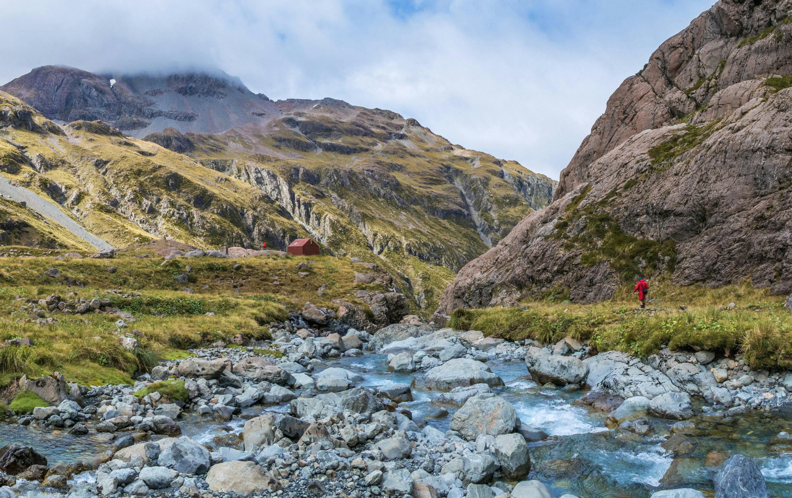
Waimakariri Falls Hut is spectacularly perched near the edge of muscular red cliffs and a yawning chasm, worn down by headwaters all concentrated into one channel.
While we were there, high cloud swirled around the tops. Rolleston to the east disappeared from view, but Waimakariri Col (1787m) was clear at the northern end of the valley. A lovely tarn near the hut completed the picture-perfect setting.
- Distance
- 20km
- Total Ascent
- 940m
- Grade
- Moderate / Difficult
- Time
- Klondyke Corner to Carrington Hut, 4-5hr; To Waimakariri Falls Hut 2-3hr
- Accom.
- Carrington Hut ($15, 36 bunks), Waimakariri Falls Hut ($5 – payable to Canterbury Mountaineering Club – six bunks)
- Access
- From SH73, Klondyke Corner car park
- Map
- BV20
GPX File
- Waimakariri Falls Hut (gpx, 8 KB)
GPX File
- Your device does not support GPX files. Please try a different device.
