
Mt Tongariro via Tama Lakes, Tongariro National Park / moderate
The Tongariro Alpine Crossing and the Northern Circuit are almost victims of their own popularity; stunningly beautiful yet hardly a wilderness experience or escape from the crowds. But there is still scope to travel off track and experience the barren volcanic landscape, glacial valleys, dramatic red rocky outcrops and the soaring pyramid of Ngauruhoe without following in the footsteps of an ant-like trail of other walkers.
We set out from Whakapapa Village along the track towards Tama Lakes. This forms part of the Northern Circuit Great Walk and is of a high standard.
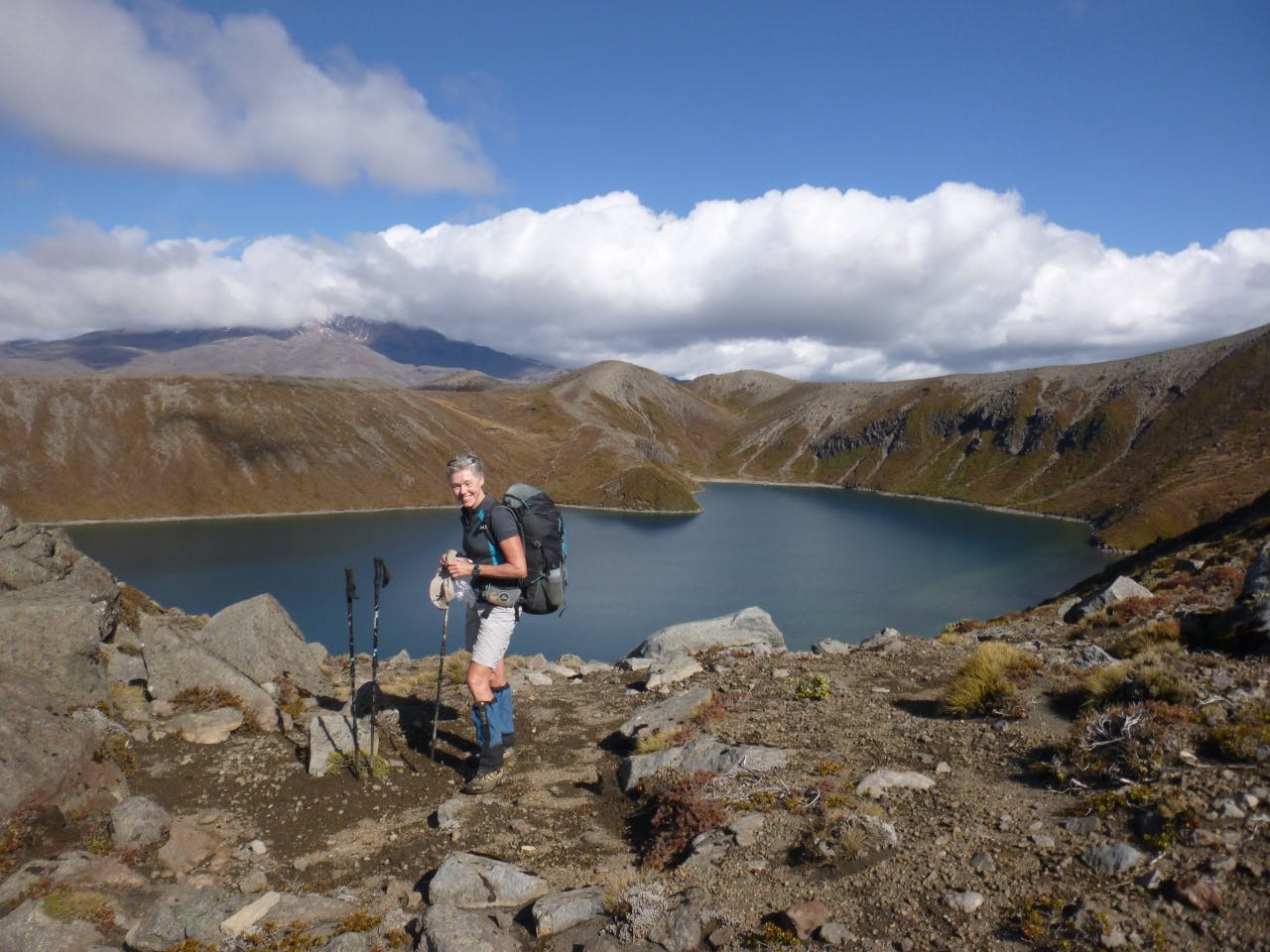
The Tama Lakes are two in-filled explosion craters named after Tamatea, the high chief of the Takatimu canoe, who explored the region some 600 years ago. The lower lake, at 1200m, is just 10 minutes from the Round the Mountain Track and we climbed on up the steep ridge to where the track ends above the glorious upper Tama Lake (1314m). Then, it was further upwards along the defined ridge west and north of the lake to the shoulder below point 1650, before sidling eastwards to the lake shore. A short climb brought us up to one of my favourite places in the park – a kind of isolated rift valley funnelled between the steep volcanic walls of points 1584 and 1562 and with the perfect cone of Mt Ngauruhoe towering almost 1000m above. Between 1912 and 1927, Horace Holl became a central figure in discovering climbing routes within Tongariro National Park and Holl’s Rock above Upper Tama Lake was one of his favourite climbs and perhaps one of the first true crag routes in New Zealand. The place feels like a scene out of an old western movie where hardy, short clumps of tussock poke bravely through the desert-like terrain and isolated larger rocks are a reminder of the force of volcanic eruptions.
We traversed eastwards, over rugged open slopes with views that stretched down towards the Waihononu – Oturere Track and the Desert Road with the Kaimanawa Ranges in the distance, making our way over rocky basalt ridges and multiple dried up water courses. It is a vast landscape, unmodified by tracks and devoid of other walkers.
A steady climb up the south-eastern flanks of Ngauruhoe (avoiding the bluffed headwaters of the valley) brought us to a shoulder and an easy scramble down to South Crater on the Tongariro Alpine Crossing. We re-joined the multinational masses for the climb up the ridge towards Red Crater, before turning off towards the summit of Mt Tongariro.
On a fine day, the views are spectacular – a glimpse of the brilliantly hued Emerald Lakes, Blue Lake in the distance beyond Central Crater and the bright yellow and orange scoria rock outcrops on the ridge that separates South and Central Craters. From the summit of Tongariro, we left the marked track, descending south-west across the dry headwaters of the Whanganui River to pick up a strong ridge – known as Hardmans Ridge – offering easy travel to Pt1409.
We were fortunate to find a trickle of water in a stream and a small flat patch to set up our tent. By 6pm the temperature had plummeted and we were treated to an exquisite sunset, which painted the peaks and tussocks around us with a golden light. We awoke to another perfect day and followed the ridge for about 1km before dropping off it to cross the Mangatepopo Stream about 10 minutes before Mangatepopo Hut. Already there was a constant stream of walkers heading off on the TAC and it was hard to believe we had spent the night so near and yet so isolated from others.
We stopped at the hut to replenish our water bottles and then set off back to Whakapapa along the pleasant undulating Mangatepopo Track with standout views of Mt Ngauruhoe and Ruapehu.
– Lisa Mead
Wild File:
Access: Whakapapa Village
Grade: Moderate
Time: Whakapapa Village to Pt1409 campsite, 7-8hr; Campsite to Whakapapa Village via Mangatepopo Hut, 3-3.5hr
Distance: 31.6km
Total ascent: 1735m
Accommodation: Camping (though not permitted within 500m of the tracks); Mangatepopo Hut,
Map: BJ34, BJ35, BH34, BH35